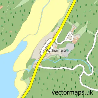
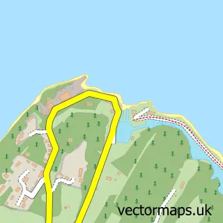
This Ardrishaig street map is a detailed vector street map covering a 750m x 750m area. Select a larger area to create and download your own vector street map of Ardrishaig.
The 750-metre map sample for Ardrishaig covers 170 mapped buildings and approximately 13.2 km of road detail, of which 11 named roads are named. The immediate area includes 1 GP surgery within 2 miles and 2 MOT stations within 2 miles. The wider area around Ardrishaig features 2 tourism points of interest, 3 food and drink venues and 2 hotels. To create a larger or custom map of Ardrishaig, the map builder lets you define your own coverage area and download editable SVG, PDF and PNG files.
Create a larger editable map of Ardrishaig
Choose any area you need and generate a high-quality vector map instantly. Perfect for print, planning, design, business and personal use.

This Ardrishaig street map in Argyll and Bute is available as downloadable SVG, PDF and PNG map files, or as a printed map for planning, business, display, education, local information and design work. You can also create a larger custom map area using the map selector.
What this Ardrishaig map sample shows
Ardrishaig lies within Argyll And Bute parish, part of Mid Argyll ward in the Argyll And Bute local authority area. The postcode geography for this area includes the PA postcode area, the PA30 postcode district and the PA30 8 postcode sector. Residents fall under the Highland for NHS services.
Local features near Ardrishaig
Within 2 milesAmenities and services in and around Ardrishaig.
Administrative and postcode information for Ardrishaig
Ardrishaig lies within Argyll And Bute parish, part of Mid Argyll ward in the Argyll And Bute local authority area. The postcode geography for this area includes the PA postcode area, the PA30 postcode district and the PA30 8 postcode sector. Residents fall under the Highland for NHS services.
Nearby street map samples around Ardrishaig

More street maps in Argyll and Bute
750 metre map area coverage
Boundary, postcode and point of interest information for the 750m x 750m rectangle centred on this sample map.
Boundaries containing map centre
Constituency: Argyll, Bute and South Lochaber Co Const
District: Argyll and Bute
Icb: Highland
Postcode District: PA30
Postcode Sector: PA30 8
Ward: Mid Argyll Ward
Nearby boundaries intersecting sample
No additional intersecting boundaries found.
Postcode coverage
POI category counts
Cafe: 2
Convenience Store: 2
Hotel: 2
Landmark And Historical Building: 2
Outdoor Gear: 2
Automotive Repair: 1
Bar: 1
Car Dealer: 1
Charity Organization: 1
Engineering Services: 1
Sample points of interest
- Pier Garage
- The Lorne Bar
- The Rumblin Tum
- The Steamer Terminal
- West Coast Motors
- The Ardrishaig Bothy
- KeyStore More
- Morrisons Daily
- Lock 3 Engineering
- Ardrishaig Public Hall
- Flowers by Morna
- Casa Argyll
Create a larger editable map of Ardrishaig
This sample shows only a 750 metre area. To create a larger map of Ardrishaig, use our map builder to choose your own coverage area, add titles and download editable SVG, PDF and PNG files.
Create a custom map of Ardrishaig