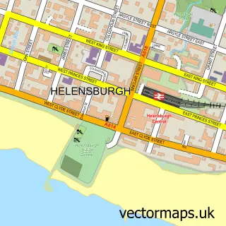
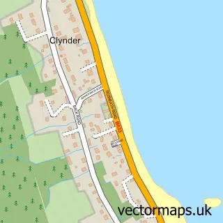
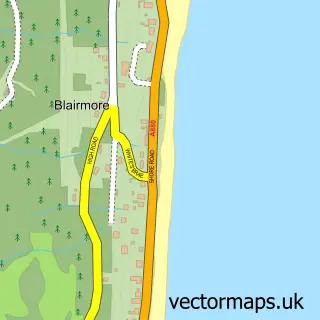
This Garelochhead street map is a detailed vector street map covering a 750m x 750m area. Select a larger area to create and download your own vector street map of Garelochhead.
The 750-metre map sample for Garelochhead covers 145 mapped buildings and approximately 10.6 km of road detail, of which 12 named roads are named. The immediate area includes 1 railway station, 1 GP surgery within 2 miles, 1 pub and 1 MOT station. The wider area around Garelochhead features 4 food and drink venues and 1 hotel. To create a larger or custom map of Garelochhead, the map builder lets you define your own coverage area and download editable SVG, PDF and PNG files.
Create a larger editable map of Garelochhead
Choose any area you need and generate a high-quality vector map instantly. Perfect for print, planning, design, business and personal use.

This Garelochhead street map in Dunbartonshire is available as downloadable SVG, PDF and PNG map files, or as a printed map for planning, business, display, education, local information and design work. You can also create a larger custom map area using the map selector.
What this Garelochhead map sample shows
Garelochhead lies within Argyll And Bute parish, part of Lomond North ward in the Argyll And Bute local authority area. The postcode geography for this area includes the G postcode area, the G84 postcode district and the G84 0 postcode sector. Residents fall under the Highland for NHS services.
Local features near Garelochhead
Within 2 milesAmenities and services in and around Garelochhead.
Administrative and postcode information for Garelochhead
The local authority covering Garelochhead is Argyll And Bute, within the county of Dunbartonshire. The settlement lies within Lomond North ward and Argyll And Bute civil parish. The G84 postcode district and G84 0 postcode sector serve the immediate area. NHS provision in the area is delivered through Highland.
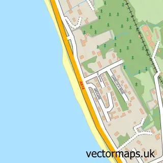
Nearby street map samples around Garelochhead

More street maps in Dunbartonshire
750 metre map area coverage
Boundary, postcode and point of interest information for the 750m x 750m rectangle centred on this sample map.
Boundaries containing map centre
Constituency: Argyll, Bute and South Lochaber Co Const
District: Argyll and Bute
Icb: Highland
Postcode District: G84
Postcode Sector: G84 0
Ward: Lomond North Ward
Nearby boundaries intersecting sample
No additional intersecting boundaries found.
Postcode coverage
POI category counts
Automotive Repair: 4
Beauty Salon: 2
Cafe: 2
Community Center: 2
Convenience Store: 2
Korean Grocery Store: 2
Pharmacy: 2
Train Station: 2
Asian Fusion Restaurant: 1
Banks: 1
Sample points of interest
- Ali fish&chips And curry House
- Autopoint
- Autopoint Fast Fit Garelochhead
- Fast Fit
- Fastfit autopoint
- Community Banker Centre 81
- Ross at Hair Design
- Hair Design
- Ross at Hair Design
- The Perch Garelochhead
- The Terrace Coffee House
- Garelochhead
Create a larger editable map of Garelochhead
This sample shows only a 750 metre area. To create a larger map of Garelochhead, use our map builder to choose your own coverage area, add titles and download editable SVG, PDF and PNG files.
Create a custom map of Garelochhead