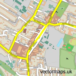
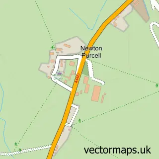
This Westbury street map is a detailed vector street map covering a 750m x 750m area. Select a larger area to create and download your own vector street map of Westbury.
The 750-metre map sample for Westbury covers 160 mapped buildings and approximately 12.3 km of road detail, of which 9 named roads are named. The immediate area includes 1 school and 2 MOT stations within 2 miles. The wider area around Westbury features 1 tourism point of interest and 1 food and drink venue. To create a larger or custom map of Westbury, the map builder lets you define your own coverage area and download editable SVG, PDF and PNG files.
Create a larger editable map of Westbury
Choose any area you need and generate a high-quality vector map instantly. Perfect for print, planning, design, business and personal use.

This Westbury street map in Buckinghamshire is available as downloadable SVG, PDF and PNG map files, or as a printed map for planning, business, display, education, local information and design work. You can also create a larger custom map area using the map selector.
What this Westbury map sample shows
Westbury lies within Westbury Cp parish, part of Tingewick ward in the Buckinghamshire local authority area. The postcode geography for this area includes the NN postcode area, the NN13 postcode district and the NN13 5 postcode sector. Residents fall under the Nhs Buckinghamshire, Oxfordshire And Berkshire West Integrated Care Board for NHS services.
Local features near Westbury
Within 2 milesAmenities and services in and around Westbury.
Administrative and postcode information for Westbury
Westbury lies within Westbury Cp parish, part of Tingewick ward in the Buckinghamshire local authority area. The postcode geography for this area includes the NN postcode area, the NN13 postcode district and the NN13 5 postcode sector. Residents fall under the Nhs Buckinghamshire, Oxfordshire And Berkshire West Integrated Care Board for NHS services.
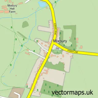
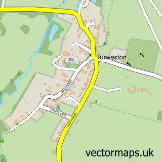
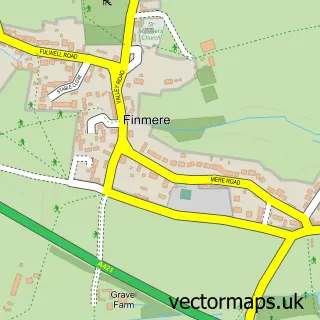
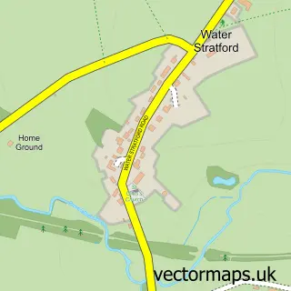
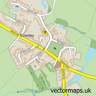
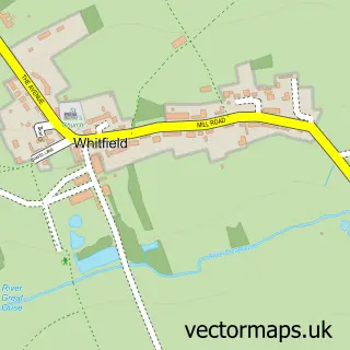
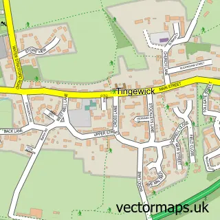
Nearby street map samples around Westbury

More street maps in Buckinghamshire
750 metre map area coverage
Boundary, postcode and point of interest information for the 750m x 750m rectangle centred on this sample map.
Boundaries containing map centre
Constituency: Buckingham and Bletchley Co Const
District: Buckinghamshire
Icb: NHS Thames Valley ICB
Parish: Westbury CP
Police Force: thames valley
Postcode District: NN13
Postcode Sector: NN13 5
Ward: Buckingham Ward
Nearby boundaries intersecting sample
Constituency: Bicester and Woodstock Co Const
County: Oxfordshire County
District: Cherwell District
Parish: Mixbury CP
Ward: Fringford & Heyfords Ward
Postcode coverage
POI category counts
Contractor: 2
Anglican Church: 1
Art Gallery: 1
Bakery: 1
Business Consulting: 1
Cafe: 1
Church Cathedral: 1
Home Improvement Store: 1
Landmark And Historical Building: 1
Landscape Architect: 1
Sample points of interest
- St Augustine's Westbury
- West Works Studio
- Old Cobblers Bakehouse
- Businesses Work
- Westbury Community Shop and cafe
- St Augustine's Church
- Ernson Services
- RS Haynes Contracting
- Ernson Property care and Improvement
- Westbury, Buckinghamshire
- Sanctuary Landscape
- Gables Breastfeeding Clinic
Create a larger editable map of Westbury
This sample shows only a 750 metre area. To create a larger map of Westbury, use our map builder to choose your own coverage area, add titles and download editable SVG, PDF and PNG files.
Create a custom map of Westbury