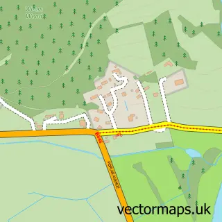
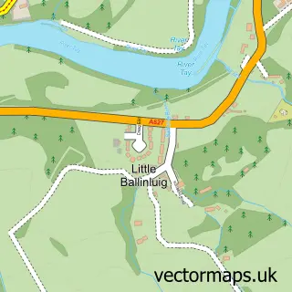
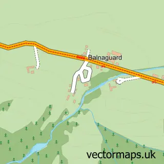
This Aberfeldy street map is a detailed vector street map covering a 750m x 750m area. Select a larger area to create and download your own vector street map of Aberfeldy.
The 750-metre map sample for Aberfeldy covers 218 mapped buildings and approximately 17.5 km of road detail, of which 33 named roads are named. The immediate area includes 1 GP surgery, 2 pubs and 1 MOT station, with 2 within 2 miles. The wider area around Aberfeldy features 9 tourism points of interest, 14 food and drink venues and 9 hotels. To create a larger or custom map of Aberfeldy, the map builder lets you define your own coverage area and download editable SVG, PDF and PNG files.
Create a larger editable map of Aberfeldy
Choose any area you need and generate a high-quality vector map instantly. Perfect for print, planning, design, business and personal use.

This Aberfeldy street map in Perth and Kinross is available as downloadable SVG, PDF and PNG map files, or as a printed map for planning, business, display, education, local information and design work. You can also create a larger custom map area using the map selector.
What this Aberfeldy map sample shows
Aberfeldy lies within Perth And Kinross parish, part of Highland ward in the Perth And Kinross local authority area. The postcode geography for this area includes the PH postcode area, the PH15 postcode district and the PH15 2 postcode sector. Residents fall under the Tayside for NHS services.
Local features near Aberfeldy
Within 2 milesAmenities and services in and around Aberfeldy.
Administrative and postcode information for Aberfeldy
Aberfeldy lies within Perth And Kinross parish, part of Highland ward in the Perth And Kinross local authority area. The postcode geography for this area includes the PH postcode area, the PH15 postcode district and the PH15 2 postcode sector. Residents fall under the Tayside for NHS services.
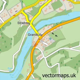
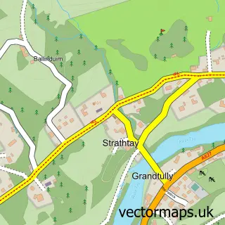
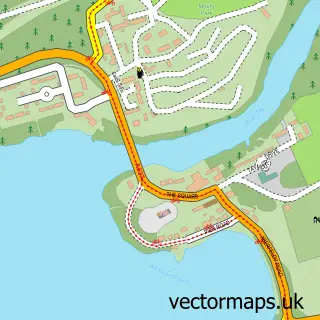
Nearby street map samples around Aberfeldy

More street maps in Perth and Kinross
750 metre map area coverage
Boundary, postcode and point of interest information for the 750m x 750m rectangle centred on this sample map.
Boundaries containing map centre
Constituency: Angus and Perthshire Glens Co Const
District: Perth and Kinross
Icb: Tayside
Postcode District: PH15
Postcode Sector: PH15 2
Ward: Highland Ward
Nearby boundaries intersecting sample
No additional intersecting boundaries found.
Postcode coverage
POI category counts
Hotel: 9
Professional Services: 7
Cafe: 5
Convenience Store: 5
Landmark And Historical Building: 5
Art Gallery: 4
Banks: 4
Bed And Breakfast: 4
Bookstore: 4
Flowers And Gifts Shop: 4
Sample points of interest
- Jill Storstein Acupuncture and Nutrition
- EMB Graphics
- Glenlyon Tweed Mill
- Must Eat
- Mckenzie Strickland Associates
- Eolas Architects
- Aberfeldy Gallery
- Artisanand
- Artisanand Ltd
- Ryan Hannigan Fine Art and Design
- The Yellow House Art Classes
- Hand Carved Wood
Create a larger editable map of Aberfeldy
This sample shows only a 750 metre area. To create a larger map of Aberfeldy, use our map builder to choose your own coverage area, add titles and download editable SVG, PDF and PNG files.
Create a custom map of Aberfeldy