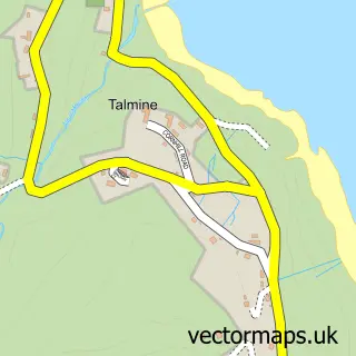
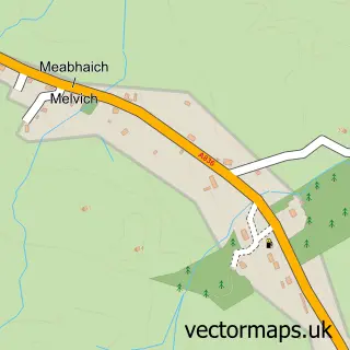
This Bettyhill street map is a detailed vector street map covering a 750m x 750m area. Select a larger area to create and download your own vector street map of Bettyhill.
The 750-metre map sample for Bettyhill covers 61 mapped buildings and approximately 5.1 km of road detail. The wider area around Bettyhill features 3 tourism points of interest, 2 food and drink venues and 2 hotels. To create a larger or custom map of Bettyhill, the map builder lets you define your own coverage area and download editable SVG, PDF and PNG files.
Create a larger editable map of Bettyhill
Choose any area you need and generate a high-quality vector map instantly. Perfect for print, planning, design, business and personal use.

This Bettyhill street map in Sutherland is available as downloadable SVG, PDF and PNG map files, or as a printed map for planning, business, display, education, local information and design work. You can also create a larger custom map area using the map selector.
What this Bettyhill map sample shows
Bettyhill lies within Highland parish, part of North, West And Central Sutherland ward in the Highland local authority area. The postcode geography for this area includes the KW postcode area, the KW14 postcode district and the KW14 7 postcode sector. Residents fall under the Highland for NHS services.
Local features near Bettyhill
Within 2 milesAmenities and services in and around Bettyhill.
Administrative and postcode information for Bettyhill
Bettyhill lies within Highland parish, part of North, West And Central Sutherland ward in the Highland local authority area. The postcode geography for this area includes the KW postcode area, the KW14 postcode district and the KW14 7 postcode sector. Residents fall under the Highland for NHS services.
Nearby street map samples around Bettyhill

More street maps in Sutherland
750 metre map area coverage
Boundary, postcode and point of interest information for the 750m x 750m rectangle centred on this sample map.
Boundaries containing map centre
Constituency: Caithness, Sutherland and Easter Ross Co Const
District: Highland
Icb: Highland
Postcode District: KW14
Postcode Sector: KW14 7
Ward: North, West and Central Sutherland Ward
Nearby boundaries intersecting sample
No additional intersecting boundaries found.
Postcode coverage
POI category counts
Cafe: 2
Campground: 2
Hotel: 2
Automotive Repair: 1
Beach: 1
Catholic Church: 1
Doctor: 1
Education: 1
Fair: 1
History Museum: 1
Sample points of interest
- Bettyhill garage
- Farr Beach, Bettyhill
- Clachan Cafe - Bettyhill
- The Store Bistro & Bar
- Craigdhu - Bettyhill Caravan and Campsite
- Craigdhu Caravan and Camping Site
- Altnaharra and Farr
- Armadale Medical Practice (Bettyhill Surgery)
- Farr High School
- North Coast Leisure Centre
- Strathnaver Museum
- Bettyhill Hotel
Create a larger editable map of Bettyhill
This sample shows only a 750 metre area. To create a larger map of Bettyhill, use our map builder to choose your own coverage area, add titles and download editable SVG, PDF and PNG files.
Create a custom map of Bettyhill