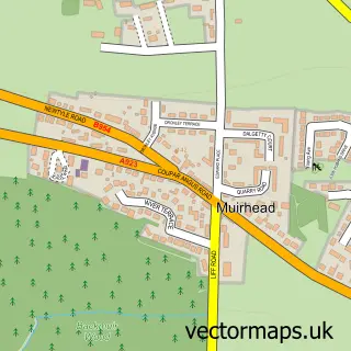
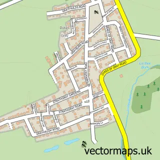
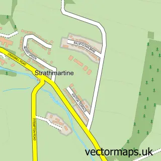
This Birkhill street map is a detailed vector street map covering a 750m x 750m area. Select a larger area to create and download your own vector street map of Birkhill.
The 750-metre map sample for Birkhill covers 481 mapped buildings and approximately 14.7 km of road detail, of which 26 named roads are named. The immediate area includes 1 GP surgery within 2 miles, 1 pub and 5 MOT stations within 2 miles. The wider area around Birkhill features 2 food and drink venues. To create a larger or custom map of Birkhill, the map builder lets you define your own coverage area and download editable SVG, PDF and PNG files.
Create a larger editable map of Birkhill
Choose any area you need and generate a high-quality vector map instantly. Perfect for print, planning, design, business and personal use.

This Birkhill street map in Angus is available as downloadable SVG, PDF and PNG map files, or as a printed map for planning, business, display, education, local information and design work. You can also create a larger custom map area using the map selector.
What this Birkhill map sample shows
Birkhill lies within Angus parish, part of Monifieth And Sidlaw ward in the Angus local authority area. The postcode geography for this area includes the DD postcode area, the DD2 postcode district and the DD2 5 postcode sector. Residents fall under the Tayside for NHS services.
Local features near Birkhill
Within 2 milesAmenities and services in and around Birkhill.
Administrative and postcode information for Birkhill
Birkhill lies within Angus parish, part of Monifieth And Sidlaw ward in the Angus local authority area. The postcode geography for this area includes the DD postcode area, the DD2 postcode district and the DD2 5 postcode sector. Residents fall under the Tayside for NHS services.
Nearby street map samples around Birkhill

More street maps in Angus
750 metre map area coverage
Boundary, postcode and point of interest information for the 750m x 750m rectangle centred on this sample map.
Boundaries containing map centre
Constituency: Angus and Perthshire Glens Co Const
District: Angus
Icb: Tayside
Postcode District: DD2
Postcode Sector: DD2 5
Ward: Monifieth and Sidlaw Ward
Nearby boundaries intersecting sample
Constituency: Dundee Central Burgh Const
District: Dundee City
Ward: Strathmartine Ward
Postcode coverage
POI category counts
Carpenter: 2
Gas Station: 2
Advertising Agency: 1
Appliance Repair Service: 1
Atms: 1
Auto Electrical Repair: 1
Beauty Salon: 1
Building Supply Store: 1
Business Management Services: 1
Child Care And Day Care: 1
Sample points of interest
- Arc Visual Communications
- A C Appliance Repairs
- Asda (C) Birkhill PFS - ERF, Main Street Birkhill
- Dunmar Electrical
- birkienails by Wendy
- ABC Builders
- Geomem Ltd.
- Birkhill Joiners
- Robbie Millar Joinery Ltd.
- Boost
- Costa Express
- Follow My Lead
Create a larger editable map of Birkhill
This sample shows only a 750 metre area. To create a larger map of Birkhill, use our map builder to choose your own coverage area, add titles and download editable SVG, PDF and PNG files.
Create a custom map of Birkhill