Vector Maps logo
Home Why it works Popular maps Districts Samples Customizer Create Your Map
VectorMaps.uk
Home Popular maps Districts Samples Customizer Create Your Map Privacy Disclaimer
Home / UK Maps / Dunbartonshire / Cardross Map

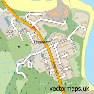
This Cardross street map is a detailed vector street map covering a 750m x 750m area. Select a larger area to create and download your own vector street map of Cardross.

Cardross is a village in Dunbartonshire, in the West Scotland of Scotland. The settlement falls within the Argyll And Bute parliamentary constituency. It is served by the G82 postcode district, with G82 5 as the local postcode sector.

The 750-metre map sample for Cardross covers 396 mapped buildings and approximately 13.8 km of road detail, of which 29 named roads are named. The immediate area includes 1 railway station. To create a larger or custom map of Cardross, the map builder lets you define your own coverage area and download editable SVG, PDF and PNG files.

396Buildings
13.84 kmRoads
29Named roads
0Residents within 2 miles
Create your own

Create a larger editable map of Cardross

Choose any area you need and generate a high-quality vector map instantly. Perfect for print, planning, design, business and personal use.

Choose any location
Editable SVG files
Any size up to A0
PDF, PNG & more
Instant download
High quality guaranteed
Create My Custom Map
Secure, private & no credit card required
Cardross Vector Street Map
750m Sample
Cardross vector street map sample showing roads, buildings and local features in a 750 metre preview area
Buy Cardross Map Print from £12.95 Buy Cardross Digital Map from £6

This Cardross street map in Dunbartonshire is available as downloadable SVG, PDF and PNG map files, or as a printed map for planning, business, display, education, local information and design work. You can also create a larger custom map area using the map selector.

What this Cardross map sample shows

Cardross lies within Argyll And Bute parish, part of Helensburgh And Lomond South ward in the Argyll And Bute local authority area. The postcode geography for this area includes the G postcode area, the G82 postcode district and the G82 5 postcode sector. Residents fall under the Highland for NHS services.

Local features near Cardross

Within 2 miles

Amenities and services in and around Cardross.

1 Railway stations
1 Healthcare POIs
1 Vehicle services

Counts are approximate and based on publicly available data.

Administrative and postcode information for Cardross

The local authority covering Cardross is Argyll And Bute, within the county of Dunbartonshire. The settlement lies within Helensburgh And Lomond South ward and Argyll And Bute civil parish. The G82 postcode district and G82 5 postcode sector serve the immediate area. NHS provision in the area is delivered through Highland.

Parish ARGYLL AND BUTE
Ward Helensburgh and Lomond South
District / local authority Argyll and Bute
County Dunbartonshire
Historic county Dunbartonshire
Postcode district G82
Postcode sector G82 5
Parliamentary constituency Argyll and Bute
Region West Scotland
Country Scotland

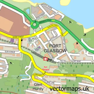
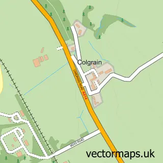
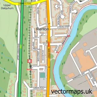
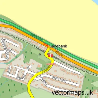
Nearby street map samples around Cardross

Street map sample of Port Glasgow, Renfrewshire Port Glasgow Town - Renfrewshire - 2.4 miles Street map sample of Glasgow, City of Glasgow Glasgow City - City of Glasgow - 17.1 miles Street map sample of Colgrain, Dunbartonshire Colgrain Village - Dunbartonshire - 2.1 miles Street map sample of Renton, Dunbartonshire Renton Village - Dunbartonshire - 2.7 miles Street map sample of Langbank, Renfrewshire Langbank Village - Renfrewshire - 3.7 miles Street map sample of Jamestown, Dunbartonshire Jamestown Village - Dunbartonshire - 4.0 miles Street map sample of Kilmacolm, Renfrewshire Kilmacolm Village - Renfrewshire - 4.9 miles Street map sample of Milton, Dunbartonshire Milton Village - Dunbartonshire - 5.5 miles Street map sample of Rhu, Dunbartonshire Rhu Village - Dunbartonshire - 6.2 miles Street map sample of Rosneath, Dunbartonshire Rosneath Village - Dunbartonshire - 6.6 miles

More street maps in Dunbartonshire

Street map sample of Colgrain, Dunbartonshire Colgrain Village - 2.1 miles Street map sample of Renton, Dunbartonshire Renton Village - 2.7 miles Street map sample of Alexandria, Dunbartonshire Alexandria Town - 3.2 miles Street map sample of Bonhill, Dunbartonshire Bonhill Town - 3.3 miles Street map sample of Dumbarton, Dunbartonshire Dumbarton Town - 3.4 miles

750 metre map area coverage

Boundary, postcode and point of interest information for the 750m x 750m rectangle centred on this sample map.

Boundaries containing map centre

Constituency: Argyll, Bute and South Lochaber Co Const

District: Argyll and Bute

Icb: Highland

Postcode District: G82

Postcode Sector: G82 5

Ward: Helensburgh and Lomond South Ward

Nearby boundaries intersecting sample

No additional intersecting boundaries found.

Postcode coverage

G82 G82 5

POI category counts

Convenience Store: 3

Train Station: 3

Beauty Salon: 2

Church Cathedral: 2

Golf Course: 2

Home Cleaning: 2

Package Locker: 2

Plumbing: 2

Advertising Agency: 1

Amateur Sports Team: 1

Sample points of interest

  • Afriasia & Beyond Advertising Agency
  • Cardross AFC Amateur Sports Team
  • Cardross Autos Automotive Repair
  • Bloom & Beauty Cardross Beauty Salon
  • The cutting room hair salon Beauty Salon
  • Lomond Bike Buddy Bicycle Shop
  • Dream Day Flowers Bridal Shop
  • Cardross Crematorium Cemeteries
  • Cardross Parish Church Church Cathedral
  • St Mahews Catholic Church Church Cathedral
  • Cardross Sports Centre Community Services Non Profits
  • Best-one Convenience Store

Create a larger editable map of Cardross

This sample shows only a 750 metre area. To create a larger map of Cardross, use our map builder to choose your own coverage area, add titles and download editable SVG, PDF and PNG files.

Create a custom map of Cardross

Phone 01751 473136 | Copyright Vectormaps.uk 2026

Samples Customizer Privacy Disclaimer
Cardross Vector Street Map
Cardross enlarged street map sample showing a 750 metre preview area