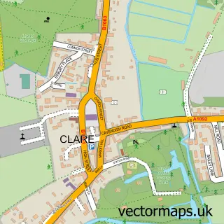
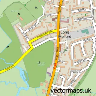
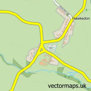
This Cavendish street map is a detailed vector street map covering a 750m x 750m area. Select a larger area to create and download your own vector street map of Cavendish.
The 750-metre map sample for Cavendish covers 213 mapped buildings and approximately 10.0 km of road detail, of which 9 named roads are named. The immediate area includes 1 school, 1 GP surgery within 2 miles, 3 pubs and 2 MOT stations within 2 miles. The wider area around Cavendish features 3 food and drink venues. To create a larger or custom map of Cavendish, the map builder lets you define your own coverage area and download editable SVG, PDF and PNG files.
Create a larger editable map of Cavendish
Choose any area you need and generate a high-quality vector map instantly. Perfect for print, planning, design, business and personal use.

This Cavendish street map in Suffolk is available as downloadable SVG, PDF and PNG map files, or as a printed map for planning, business, display, education, local information and design work. You can also create a larger custom map area using the map selector.
What this Cavendish map sample shows
Cavendish lies within Cavendish Cp parish, part of Clare, Hundon & Kedington ward in the West Suffolk District local authority area. The postcode geography for this area includes the CO postcode area, the CO10 postcode district and the CO10 8 postcode sector. Residents fall under the Nhs Suffolk And North East Essex Integrated Care Board for NHS services.
Local features near Cavendish
Within 2 milesAmenities and services in and around Cavendish.
Administrative and postcode information for Cavendish
The local authority covering Cavendish is West Suffolk District, within the county of Suffolk. The settlement lies within Clare, Hundon & Kedington ward and Cavendish Cp civil parish. The CO10 postcode district and CO10 8 postcode sector serve the immediate area. NHS provision in the area is delivered through West Suffolk Nhs Foundation Trust.
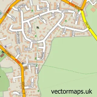
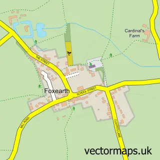
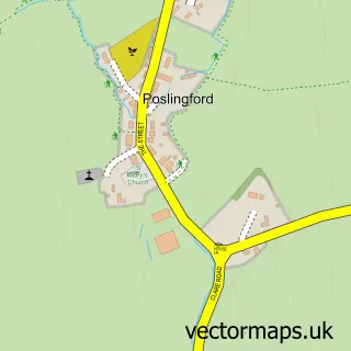
Nearby street map samples around Cavendish

More street maps in Suffolk
750 metre map area coverage
Boundary, postcode and point of interest information for the 750m x 750m rectangle centred on this sample map.
Boundaries containing map centre
Constituency: West Suffolk Co Const
County: Suffolk County
District: West Suffolk District
Icb: NHS Essex ICB
Parish: Cavendish CP
Police Force: suffolk
Postcode District: CO10
Postcode Sector: CO10 8
Ward: Clare, Hundon & Kedington Ward
Nearby boundaries intersecting sample
Constituency: Braintree Co Const
County: Essex County
District: Braintree District
Parish: Pentlow CP
Police Force: essex
Postcode Sector: CO10 7
Ward: Stour Valley North Ward
Postcode coverage
POI category counts
Pub: 3
Assisted Living Facility: 2
Charity Organization: 2
Counseling And Mental Health: 2
Retail: 2
Accommodation: 1
Anglican Church: 1
Automotive Repair: 1
Bar: 1
Building Supply Store: 1
Sample points of interest
- Hocus Pocus Cat Hotel
- Cavendish, St Mary the Virgin
- Anchor - Devonshire House care home
- Devonshire House Care Home
- The Autobarn
- The Bull Inn
- M a Design
- Amnesty International
- Sue Ryder Cavendish
- St Mary the Virgin's Church
- Cavendish Community Shop
- EJS Counselling & Psychotherapy
Create a larger editable map of Cavendish
This sample shows only a 750 metre area. To create a larger map of Cavendish, use our map builder to choose your own coverage area, add titles and download editable SVG, PDF and PNG files.
Create a custom map of Cavendish