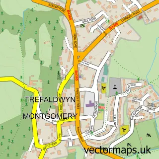
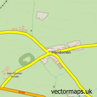
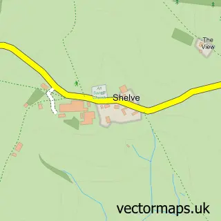
This Churchstoke street map is a detailed vector street map covering a 750m x 750m area. Select a larger area to create and download your own vector street map of Churchstoke.
The 750-metre map sample for Churchstoke covers 222 mapped buildings and approximately 31.6 km of road detail, of which 7 named roads are named. The immediate area includes 1 school, 2 pubs and 1 MOT station within 2 miles. The wider area around Churchstoke features 2 food and drink venues and 2 campsites within 2 miles. To create a larger or custom map of Churchstoke, the map builder lets you define your own coverage area and download editable SVG, PDF and PNG files.
Create a larger editable map of Churchstoke
Choose any area you need and generate a high-quality vector map instantly. Perfect for print, planning, design, business and personal use.

This Churchstoke street map in Powys is available as downloadable SVG, PDF and PNG map files, or as a printed map for planning, business, display, education, local information and design work. You can also create a larger custom map area using the map selector.
What this Churchstoke map sample shows
Churchstoke lies within Churchstoke Community parish, part of Churchstoke ward in the Powys - Powys local authority area. The postcode geography for this area includes the SY postcode area, the SY15 postcode district and the SY15 6 postcode sector. Residents fall under the Powys Teaching Health Board for NHS services.
Local features near Churchstoke
Within 2 milesAmenities and services in and around Churchstoke.
Administrative and postcode information for Churchstoke
Churchstoke lies within Churchstoke Community parish, part of Churchstoke ward in the Powys - Powys local authority area. The postcode geography for this area includes the SY postcode area, the SY15 postcode district and the SY15 6 postcode sector. Residents fall under the Powys Teaching Health Board for NHS services.
Nearby street map samples around Churchstoke

More street maps in Powys
750 metre map area coverage
Boundary, postcode and point of interest information for the 750m x 750m rectangle centred on this sample map.
Boundaries containing map centre
Constituency: Montgomeryshire and Glyndwr Co Const
District: Powys - Powys
Icb: Powys Teaching
Parish: Churchstoke Community
Police Force: dyfed-powys
Postcode District: SY15
Postcode Sector: SY15 6
Nearby boundaries intersecting sample
No additional intersecting boundaries found.
Postcode coverage
POI category counts
Pub: 2
Anglican Church: 1
Building Supply Store: 1
Chinese Restaurant: 1
Contractor: 1
Holiday Rental Home: 1
Preschool: 1
Retirement Home: 1
Sports Club And League: 1
Sample points of interest
- Churchstoke: St Nicholas
- JFP Carpentry
- Golden Fish Chinese Takeaway
- Charles Shaw Stonemasons
- The Spinney - Luxury Glamping
- Churchstoke Little Explorers Playgroup
- Horse & Jockey
- The Court House
- St Nicholas House Care Home
- Church Stoke Bowling Club
Create a larger editable map of Churchstoke
This sample shows only a 750 metre area. To create a larger map of Churchstoke, use our map builder to choose your own coverage area, add titles and download editable SVG, PDF and PNG files.
Create a custom map of Churchstoke