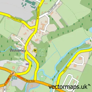
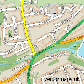
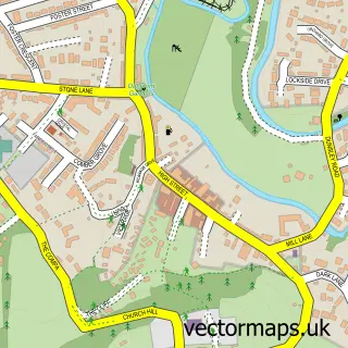
This Cookley street map is a detailed vector street map covering a 750m x 750m area. Select a larger area to create and download your own vector street map of Cookley.
The 750-metre map sample for Cookley covers 339 mapped buildings and approximately 43.4 km of road detail, of which 21 named roads are named. The immediate area includes 1 school, 2 GP surgeries within 2 miles and 4 pubs. The wider area around Cookley features 1 tourism point of interest, 6 food and drink venues and 1 campsite within 2 miles. To create a larger or custom map of Cookley, the map builder lets you define your own coverage area and download editable SVG, PDF and PNG files.
Create a larger editable map of Cookley
Choose any area you need and generate a high-quality vector map instantly. Perfect for print, planning, design, business and personal use.

This Cookley street map in Worcestershire is available as downloadable SVG, PDF and PNG map files, or as a printed map for planning, business, display, education, local information and design work. You can also create a larger custom map area using the map selector.
What this Cookley map sample shows
Cookley lies within Wolverley And Cookley Cp parish, part of Wyre Forest Rural ward in the Wyre Forest District local authority area. The postcode geography for this area includes the DY postcode area, the DY10 postcode district and the DY10 3 postcode sector. Residents fall under the Nhs Herefordshire And Worcestershire Integrated Care Board for NHS services.
Local features near Cookley
Within 2 milesAmenities and services in and around Cookley.
Administrative and postcode information for Cookley
Cookley lies within Wolverley And Cookley Cp parish, part of Wyre Forest Rural ward in the Wyre Forest District local authority area. The postcode geography for this area includes the DY postcode area, the DY10 postcode district and the DY10 3 postcode sector. Residents fall under the Nhs Herefordshire And Worcestershire Integrated Care Board for NHS services.
Nearby street map samples around Cookley

More street maps in Worcestershire
750 metre map area coverage
Boundary, postcode and point of interest information for the 750m x 750m rectangle centred on this sample map.
Boundaries containing map centre
Constituency: Wyre Forest Co Const
County: Worcestershire County
District: Wyre Forest District
Icb: NHS Herefordshire and Worcestershire ICB
Parish: Wolverley and Cookley CP
Police Force: west mercia
Postcode District: DY10
Postcode Sector: DY10 3
Ward: Wyre Forest Rural Ward
Nearby boundaries intersecting sample
No additional intersecting boundaries found.
Postcode coverage
POI category counts
Pub: 4
Building Supply Store: 3
Sports Club And League: 3
Church Cathedral: 2
Convenience Store: 2
Elementary School: 2
Post Office: 2
Professional Services: 2
Accommodation: 1
Anglican Church: 1
Sample points of interest
- Cookley Village
- St Peter, Cookley
- Upfront Entertainments Agency
- Cookley Tunnel (East End)
- Cookley Tandoori
- Beauty at No3
- Open Trail and Burlish Bike Park
- Aqua Heights
- Edn Landscapes
- G R Rowe Tarmacadam Contractors
- N a Jones Plumbing & Heating
- Food Development Services Ltd.
Create a larger editable map of Cookley
This sample shows only a 750 metre area. To create a larger map of Cookley, use our map builder to choose your own coverage area, add titles and download editable SVG, PDF and PNG files.
Create a custom map of Cookley