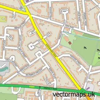
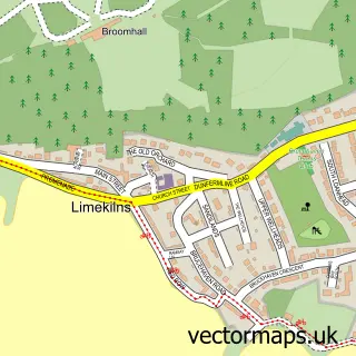
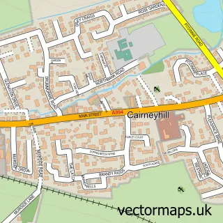
This Dunfermline street map is a detailed vector street map covering a 750m x 750m area. Select a larger area to create and download your own vector street map of Dunfermline.
The 750-metre map sample for Dunfermline covers 172 mapped buildings and approximately 19.4 km of road detail, of which 46 named roads are named. The immediate area includes 6 GP surgeries within 2 miles, 13 pubs and 1 MOT station, with 19 within 2 miles. The wider area around Dunfermline features 15 tourism points of interest, 56 food and drink venues and 2 hotels. To create a larger or custom map of Dunfermline, the map builder lets you define your own coverage area and download editable SVG, PDF and PNG files.
Create a larger editable map of Dunfermline
Choose any area you need and generate a high-quality vector map instantly. Perfect for print, planning, design, business and personal use.

This Dunfermline street map in Fife is available as downloadable SVG, PDF and PNG map files, or as a printed map for planning, business, display, education, local information and design work. You can also create a larger custom map area using the map selector.
What this Dunfermline map sample shows
Dunfermline lies within Fife parish, part of Dunfermline Central ward in the Fife local authority area. The postcode geography for this area includes the KY postcode area, the KY12 postcode district and the KY12 7 postcode sector. Residents fall under the Fife for NHS services.
Local features near Dunfermline
Within 2 milesAmenities and services in and around Dunfermline.
Administrative and postcode information for Dunfermline
Dunfermline lies within Fife parish, part of Dunfermline Central ward in the Fife local authority area. The postcode geography for this area includes the KY postcode area, the KY12 postcode district and the KY12 7 postcode sector. Residents fall under the Fife for NHS services.
Nearby street map samples around Dunfermline
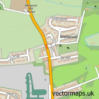
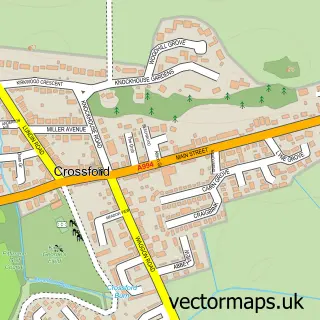
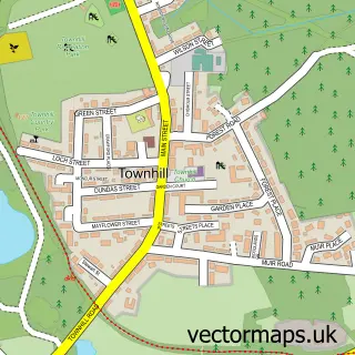
More street maps in Fife
750 metre map area coverage
Boundary, postcode and point of interest information for the 750m x 750m rectangle centred on this sample map.
Boundaries containing map centre
Constituency: Dunfermline and Dollar Co Const
District: Fife
Icb: Fife
Postcode District: KY12
Postcode Sector: KY12 7
Ward: Dunfermline Central Ward
Nearby boundaries intersecting sample
Postcode Sector: KY12 0, KY12 8, KY12 9
Ward: Dunfermline North Ward
Postcode coverage
POI category counts
Beauty Salon: 41
Hair Salon: 23
Barber: 18
Clothing Store: 17
Restaurant: 17
Dentist: 16
Tattoo And Piercing: 16
Cafe: 15
Beauty And Spa: 13
Pub: 13
Sample points of interest
- Condies CA
- Payroll Services
- TAxAssist Accountants Dunfermline
- TaxAssist Accountants
- Elite Ladies Cardio Kickboxing
- Dunfermline Acupuncture Clinic
- Simply Social
- Noble Leisure
- Tots Express
- British Red Cross
- Shelter
- Sue Ryder Care Dunfermline
Create a larger editable map of Dunfermline
This sample shows only a 750 metre area. To create a larger map of Dunfermline, use our map builder to choose your own coverage area, add titles and download editable SVG, PDF and PNG files.
Create a custom map of Dunfermline