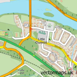
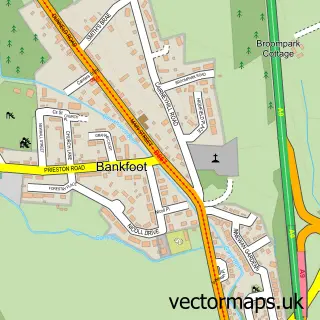
This Dunkeld street map is a detailed vector street map covering a 750m x 750m area. Select a larger area to create and download your own vector street map of Dunkeld.
The 750-metre map sample for Dunkeld covers 53 mapped buildings and approximately 9.7 km of road detail, of which 16 named roads are named. The immediate area includes 1 GP surgery within 2 miles, 2 pubs and 2 MOT stations within 2 miles. The wider area around Dunkeld features 6 tourism points of interest, 11 food and drink venues and 5 hotels. To create a larger or custom map of Dunkeld, the map builder lets you define your own coverage area and download editable SVG, PDF and PNG files.
Create a larger editable map of Dunkeld
Choose any area you need and generate a high-quality vector map instantly. Perfect for print, planning, design, business and personal use.

This Dunkeld street map in Perth and Kinross is available as downloadable SVG, PDF and PNG map files, or as a printed map for planning, business, display, education, local information and design work. You can also create a larger custom map area using the map selector.
What this Dunkeld map sample shows
Dunkeld lies within Perth And Kinross parish, part of Strathtay ward in the Perth And Kinross local authority area. The postcode geography for this area includes the PH postcode area, the PH8 postcode district and the PH8 0 postcode sector. Residents fall under the Tayside for NHS services.
Local features near Dunkeld
Within 2 milesAmenities and services in and around Dunkeld.
Administrative and postcode information for Dunkeld
Dunkeld lies within Perth And Kinross parish, part of Strathtay ward in the Perth And Kinross local authority area. The postcode geography for this area includes the PH postcode area, the PH8 postcode district and the PH8 0 postcode sector. Residents fall under the Tayside for NHS services.
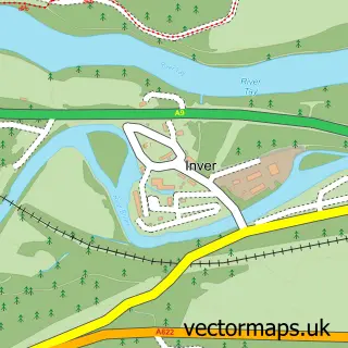
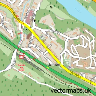
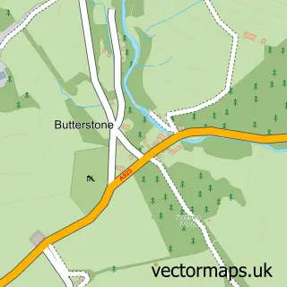
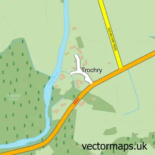
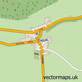
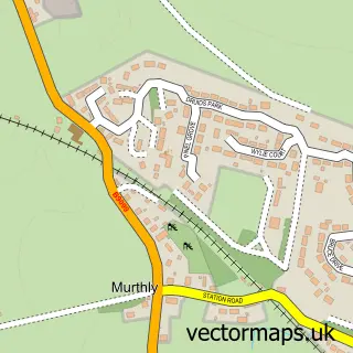
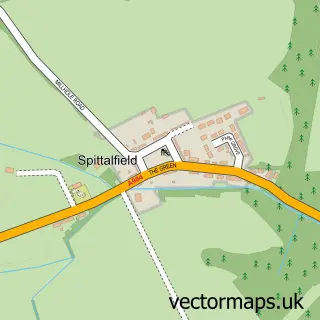
Nearby street map samples around Dunkeld

More street maps in Perth and Kinross
750 metre map area coverage
Boundary, postcode and point of interest information for the 750m x 750m rectangle centred on this sample map.
Boundaries containing map centre
Constituency: Angus and Perthshire Glens Co Const
District: Perth and Kinross
Icb: Tayside
Postcode District: PH8
Postcode Sector: PH8 0
Ward: Strathtay Ward
Nearby boundaries intersecting sample
No additional intersecting boundaries found.
Postcode coverage
POI category counts
Hotel: 5
Cafe: 4
Art Gallery: 3
Dentist: 3
Landmark And Historical Building: 3
Restaurant: 3
Arts And Crafts: 2
Attractions And Activities: 2
Bakery: 2
Bicycle Shop: 2
Sample points of interest
- Maggie Moore
- Inchmagrannachan Caravan Park
- Mary Arnold-Forster Architects
- Atholl Gallery
- Hatton House Art & Design
- MacLeod Gallery
- Going Pottie Studio & Jaggedy Thistle Gift Shop
- Kat n Kat
- Scottish Quads
- Dunkeld
- St. Ninians Garden
- ARAN Bakery
Create a larger editable map of Dunkeld
This sample shows only a 750 metre area. To create a larger map of Dunkeld, use our map builder to choose your own coverage area, add titles and download editable SVG, PDF and PNG files.
Create a custom map of Dunkeld