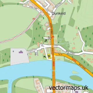
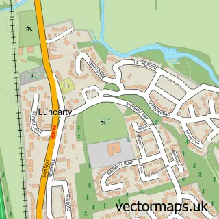
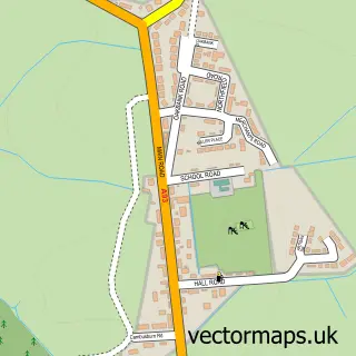
This Bankfoot street map is a detailed vector street map covering a 750m x 750m area. Select a larger area to create and download your own vector street map of Bankfoot.
The 750-metre map sample for Bankfoot covers 148 mapped buildings and approximately 19.8 km of road detail, of which 19 named roads are named. The wider area around Bankfoot features 1 tourism point of interest and 1 hotel. To create a larger or custom map of Bankfoot, the map builder lets you define your own coverage area and download editable SVG, PDF and PNG files.
Create a larger editable map of Bankfoot
Choose any area you need and generate a high-quality vector map instantly. Perfect for print, planning, design, business and personal use.

This Bankfoot street map in Perth and Kinross is available as downloadable SVG, PDF and PNG map files, or as a printed map for planning, business, display, education, local information and design work. You can also create a larger custom map area using the map selector.
What this Bankfoot map sample shows
Bankfoot lies within Perth And Kinross parish, part of Strathtay ward in the Perth And Kinross local authority area. The postcode geography for this area includes the PH postcode area, the PH1 postcode district and the PH1 4 postcode sector. Residents fall under the Tayside for NHS services.
Local features near Bankfoot
Within 2 milesAmenities and services in and around Bankfoot.
Administrative and postcode information for Bankfoot
The local authority covering Bankfoot is Perth And Kinross, within the county of Perth And Kinross. The settlement lies within Strathtay ward and Perth And Kinross civil parish. The PH1 postcode district and PH1 4 postcode sector serve the immediate area. NHS provision in the area is delivered through Tayside.
Nearby street map samples around Bankfoot

More street maps in Perth and Kinross
750 metre map area coverage
Boundary, postcode and point of interest information for the 750m x 750m rectangle centred on this sample map.
Boundaries containing map centre
Constituency: Angus and Perthshire Glens Co Const
District: Perth and Kinross
Icb: Tayside
Postcode District: PH1
Postcode Sector: PH1 4
Ward: Strathtay Ward
Nearby boundaries intersecting sample
No additional intersecting boundaries found.
Postcode coverage
POI category counts
Performing Arts: 2
Plumbing: 2
Scout Hall: 2
Sports Club And League: 2
Beauty Salon: 1
Building Supply Store: 1
Business Management Services: 1
Convenience Store: 1
Corporate Entertainment Services: 1
Electrician: 1
Sample points of interest
- Boutique Hair Nails & Beauty
- F C McDonald
- Post Office-Bankfoot
- Nisa Local
- Clare Ollif Face Painter
- A C Guild Electrical Contractor
- Katya Embroidery
- Lov Events
- Evri ParcelShop
- Bankfoot Garden Services
- Rolmar Carpet and Upholstery Cleaners
- RTM Plumbing & Heating
Create a larger editable map of Bankfoot
This sample shows only a 750 metre area. To create a larger map of Bankfoot, use our map builder to choose your own coverage area, add titles and download editable SVG, PDF and PNG files.
Create a custom map of Bankfoot