Vector Maps logo
Home Why it works Popular maps Districts Samples Customizer Create Your Map
VectorMaps.uk
Home Popular maps Districts Samples Customizer Create Your Map Privacy Disclaimer
Home / UK Maps / Perth and Kinross / Luncarty Map

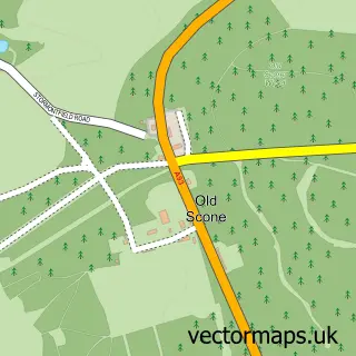
This Luncarty street map is a detailed vector street map covering a 750m x 750m area. Select a larger area to create and download your own vector street map of Luncarty.

Luncarty is a village in Perth And Kinross, in the Mid Scotland And Fife of Scotland. Historically, the area formed part of Perthshire. The settlement falls within the Ochil And South Perthshire parliamentary constituency. It is served by the PH1 postcode

The 750-metre map sample for Luncarty covers 323 mapped buildings and approximately 13.7 km of road detail, of which 18 named roads are named. To create a larger or custom map of Luncarty, the map builder lets you define your own coverage area and download editable SVG, PDF and PNG files.

323Buildings
13.68 kmRoads
18Named roads
0Residents within 2 miles
Create your own

Create a larger editable map of Luncarty

Choose any area you need and generate a high-quality vector map instantly. Perfect for print, planning, design, business and personal use.

Choose any location
Editable SVG files
Any size up to A0
PDF, PNG & more
Instant download
High quality guaranteed
Create My Custom Map
Secure, private & no credit card required
Luncarty Vector Street Map
750m Sample
Luncarty vector street map sample showing roads, buildings and local features in a 750 metre preview area
Buy Luncarty Map Print from £12.95 Buy Luncarty Digital Map from £6

This Luncarty street map in Perth and Kinross is available as downloadable SVG, PDF and PNG map files, or as a printed map for planning, business, display, education, local information and design work. You can also create a larger custom map area using the map selector.

What this Luncarty map sample shows

Luncarty lies within Perth And Kinross parish, part of Strathtay ward in the Perth And Kinross local authority area. The postcode geography for this area includes the PH postcode area, the PH1 postcode district and the PH1 3 postcode sector. Residents fall under the Tayside for NHS services.

Administrative and postcode information for Luncarty

Luncarty lies within Perth And Kinross parish, part of Strathtay ward in the Perth And Kinross local authority area. The postcode geography for this area includes the PH postcode area, the PH1 postcode district and the PH1 3 postcode sector. Residents fall under the Tayside for NHS services.

Parish PERTH AND KINROSS
Ward Strathtay
District / local authority Perth and Kinross
County Perth and Kinross
Historic county Perthshire
Postcode district PH1
Postcode sector PH1 3
Parliamentary constituency Ochil and South Perthshire
Region Mid Scotland and Fife
Country Scotland

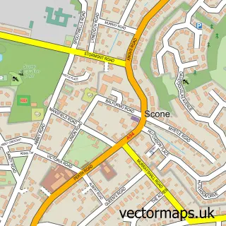
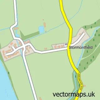
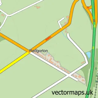
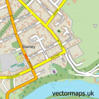
Nearby street map samples around Luncarty

Street map sample of Scone, Perth and Kinross Scone Town - Perth and Kinross - 3.4 miles Street map sample of Perth, Perth and Kinross Perth City - Perth and Kinross - 4.2 miles Street map sample of Stormontfield, Perth and Kinross Stormontfield Village - Perth and Kinross - 0.7 miles Street map sample of Redgorton, Perth and Kinross Redgorton Village - Perth and Kinross - 0.8 miles Street map sample of Stanley, Perth and Kinross Stanley Village - Perth and Kinross - 2.1 miles Street map sample of Bertha Park, Perth and Kinross Bertha Park Village - Perth and Kinross - 2.2 miles Street map sample of Old Scone, Perth and Kinross Old Scone Village - Perth and Kinross - 2.4 miles Street map sample of Guildtown, Perth and Kinross Guildtown Village - Perth and Kinross - 2.6 miles Street map sample of Pitcairngreen, Perth and Kinross Pitcairngreen Village - Perth and Kinross - 2.7 miles Street map sample of Ruthvenfield, Perth and Kinross Ruthvenfield Village - Perth and Kinross - 3.0 miles

More street maps in Perth and Kinross

Street map sample of Stormontfield, Perth and Kinross Stormontfield Village - 0.7 miles Street map sample of Redgorton, Perth and Kinross Redgorton Village - 0.8 miles Street map sample of Stanley, Perth and Kinross Stanley Village - 2.1 miles Street map sample of Bertha Park, Perth and Kinross Bertha Park Village - 2.2 miles Street map sample of Old Scone, Perth and Kinross Old Scone Village - 2.4 miles

750 metre map area coverage

Boundary, postcode and point of interest information for the 750m x 750m rectangle centred on this sample map.

Boundaries containing map centre

Constituency: Angus and Perthshire Glens Co Const

District: Perth and Kinross

Icb: Tayside

Postcode District: PH1

Postcode Sector: PH1 3

Ward: Strathtay Ward

Nearby boundaries intersecting sample

No additional intersecting boundaries found.

Postcode coverage

PH1 PH1 3

POI category counts

Sports Club And League: 3

Contractor: 2

Post Office: 2

Business Consulting: 1

Chiropractor: 1

Convenience Store: 1

Driving School: 1

Electrician: 1

Elementary School: 1

Linen: 1

Sample points of interest

  • Future Focus Scotland Business Consulting
  • Tayside Chiropractic & Wellness Clinic Chiropractor
  • C D Mercer Contractor
  • CD Mercer Contractor
  • SPAR Luncarty Convenience Store
  • Anderson Driver Training Driving School
  • Gourlay PAT Testing Electrician
  • Luncarty Primary School Elementary School
  • Bank St Studio Linen
  • Tiptoe Nail Studio Nail Salon
  • Lightly Whipped Patisserie Cake Shop
  • Luncarty Post Office Post Office

Create a larger editable map of Luncarty

This sample shows only a 750 metre area. To create a larger map of Luncarty, use our map builder to choose your own coverage area, add titles and download editable SVG, PDF and PNG files.

Create a custom map of Luncarty

Phone 01751 473136 | Copyright Vectormaps.uk 2026

Samples Customizer Privacy Disclaimer
Luncarty Vector Street Map
Luncarty enlarged street map sample showing a 750 metre preview area