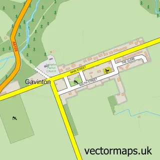
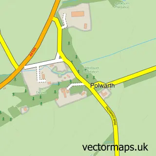
This Duns street map is a detailed vector street map covering a 750m x 750m area. Select a larger area to create and download your own vector street map of Duns.
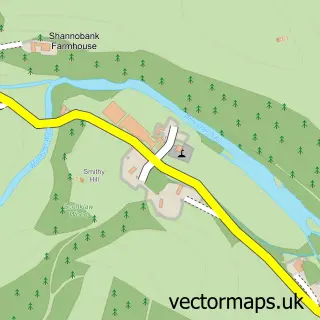
The 750-metre map sample for Duns covers 344 mapped buildings and approximately 14.4 km of road detail, of which 33 named roads are named. The immediate area includes 1 GP surgery within 2 miles, 2 pubs and 1 MOT station, with 4 within 2 miles. The wider area around Duns features 4 tourism points of interest, 5 food and drink venues and 8 hotels. To create a larger or custom map of Duns, the map builder lets you define your own coverage area and download editable SVG, PDF and PNG files.
Create a larger editable map of Duns
Choose any area you need and generate a high-quality vector map instantly. Perfect for print, planning, design, business and personal use.

This Duns street map in Berwickshire is available as downloadable SVG, PDF and PNG map files, or as a printed map for planning, business, display, education, local information and design work. You can also create a larger custom map area using the map selector.
What this Duns map sample shows
Duns lies within Scottish Borders parish, part of Mid Berwickshire ward in the Scottish Borders local authority area. The postcode geography for this area includes the TD postcode area, the TD11 postcode district and the TD11 3 postcode sector. Residents fall under the Borders for NHS services.
Local features near Duns
Within 2 milesAmenities and services in and around Duns.
Administrative and postcode information for Duns
The local authority covering Duns is Scottish Borders, within the county of Berwickshire. The settlement lies within Mid Berwickshire ward and Scottish Borders civil parish. The TD11 postcode district and TD11 3 postcode sector serve the immediate area. NHS provision in the area is delivered through Borders.
Nearby street map samples around Duns

More street maps in Berwickshire
750 metre map area coverage
Boundary, postcode and point of interest information for the 750m x 750m rectangle centred on this sample map.
Boundaries containing map centre
Constituency: Berwickshire, Roxburgh and Selkirk Co Const
District: Scottish Borders
Icb: Borders
Postcode District: TD11
Postcode Sector: TD11 3
Ward: Mid Berwickshire Ward
Nearby boundaries intersecting sample
No additional intersecting boundaries found.
Postcode coverage
POI category counts
Hotel: 8
Beauty Salon: 4
Church Cathedral: 4
Flowers And Gifts Shop: 4
Bed And Breakfast: 3
Convenience Store: 3
Dentist: 3
Grocery Store: 3
Hair Salon: 3
Atms: 2
Sample points of interest
- Duns Square
- Doyle Accountancy Ltd
- Duns Antique Centre
- Jamie Renton Rural Design Consultant
- ATM (Post Office)
- The Cooperative Food (BF) Duns, Newtown Street
- Hungry Spot
- Trotters Family Bakers
- Bank of Scotland
- Community Banker Volunteer Hall
- The Plough Inn Duns
- Chris The Barber
Create a larger editable map of Duns
This sample shows only a 750 metre area. To create a larger map of Duns, use our map builder to choose your own coverage area, add titles and download editable SVG, PDF and PNG files.
Create a custom map of Duns