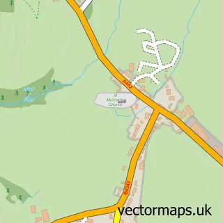
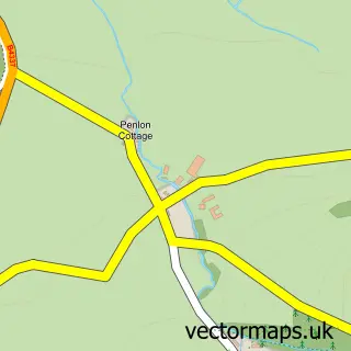
This Felinfach street map is a detailed vector street map covering a 750m x 750m area. Select a larger area to create and download your own vector street map of Felinfach.
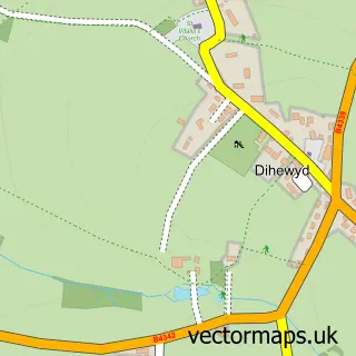
The 750-metre map sample for Felinfach covers 102 mapped buildings and approximately 5.4 km of road detail, of which 3 named roads are named. The immediate area includes 1 school and 1 MOT station. The wider area around Felinfach features 2 campsites within 2 miles. To create a larger or custom map of Felinfach, the map builder lets you define your own coverage area and download editable SVG, PDF and PNG files.
Create a larger editable map of Felinfach
Choose any area you need and generate a high-quality vector map instantly. Perfect for print, planning, design, business and personal use.

This Felinfach street map in Dyfed is available as downloadable SVG, PDF and PNG map files, or as a printed map for planning, business, display, education, local information and design work. You can also create a larger custom map area using the map selector.
What this Felinfach map sample shows
Felinfach lies within Llanfihangel Ystrad Community parish, part of Llanfihangel Ystrad ward in the Sir Ceredigion - Ceredigion local authority area. The postcode geography for this area includes the SA postcode area, the SA48 postcode district and the SA48 8 postcode sector. Residents fall under the Hywel Dda University Health Board for NHS services.
Local features near Felinfach
Within 2 milesAmenities and services in and around Felinfach.
Administrative and postcode information for Felinfach
Felinfach lies within Llanfihangel Ystrad Community parish, part of Llanfihangel Ystrad ward in the Sir Ceredigion - Ceredigion local authority area. The postcode geography for this area includes the SA postcode area, the SA48 postcode district and the SA48 8 postcode sector. Residents fall under the Hywel Dda University Health Board for NHS services.
Nearby street map samples around Felinfach

More street maps in Dyfed
750 metre map area coverage
Boundary, postcode and point of interest information for the 750m x 750m rectangle centred on this sample map.
Boundaries containing map centre
Constituency: Ceredigion Preseli Co Const
District: Sir Ceredigion - Ceredigion
Icb: Hywel Dda
Parish: Llanfihangel Ystrad Community
Police Force: dyfed-powys
Postcode District: SA48
Postcode Sector: SA48 8
Nearby boundaries intersecting sample
Postcode Sector: SA48 7
Postcode coverage
POI category counts
Convenience Store: 2
Gas Station: 2
Korean Grocery Store: 2
Agricultural Cooperatives: 1
Bar: 1
Bookstore: 1
Business Management Services: 1
Forestry Service: 1
Grocery Store: 1
Home Service: 1
Sample points of interest
- CCF Felinfach Branch
- Vale of Aeron
- Alexthefatdawg
- Cyfiaith
- Costcutter
- Premier Felinfach Post Office
- Clynderwen & Cardiganshire Farmers
- TEXACO Station
- Texaco
- D O & D W Jones
- Ffrindiau Cylch Meithrin Ynys y Plant Felinfach
- Felinfach Post Office
Create a larger editable map of Felinfach
This sample shows only a 750 metre area. To create a larger map of Felinfach, use our map builder to choose your own coverage area, add titles and download editable SVG, PDF and PNG files.
Create a custom map of Felinfach