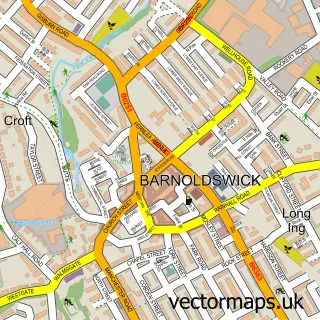
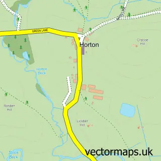
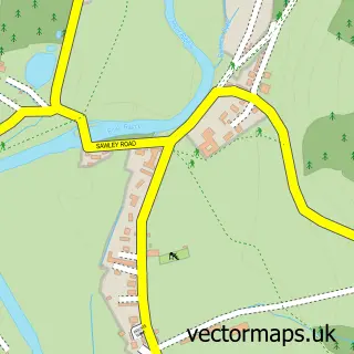
This Gisburn street map is a detailed vector street map covering a 750m x 750m area. Select a larger area to create and download your own vector street map of Gisburn.
The 750-metre map sample for Gisburn covers 115 mapped buildings and approximately 11.7 km of road detail, of which 12 named roads are named. The immediate area includes 1 school and 1 pub. The wider area around Gisburn features 3 tourism points of interest and 1 food and drink venue. To create a larger or custom map of Gisburn, the map builder lets you define your own coverage area and download editable SVG, PDF and PNG files.
Create a larger editable map of Gisburn
Choose any area you need and generate a high-quality vector map instantly. Perfect for print, planning, design, business and personal use.

This Gisburn street map in Lancashire is available as downloadable SVG, PDF and PNG map files, or as a printed map for planning, business, display, education, local information and design work. You can also create a larger custom map area using the map selector.
What this Gisburn map sample shows
Gisburn lies within Gisburn Cp parish, part of Gisburn & Rimington ward in the Ribble Valley District (B) local authority area. The postcode geography for this area includes the BB postcode area, the BB7 postcode district and the BB7 4 postcode sector. Residents fall under the Nhs Lancashire And South Cumbria Integrated Care Board for NHS services.
Local features near Gisburn
Within 2 milesAmenities and services in and around Gisburn.
Administrative and postcode information for Gisburn
The local authority covering Gisburn is Ribble Valley District (B), within the county of Lancashire. The settlement lies within Gisburn & Rimington ward and Gisburn Cp civil parish. The BB7 postcode district and BB7 4 postcode sector serve the immediate area. NHS provision in the area is delivered through East Lancashire Hospitals Nhs Trust.
Nearby street map samples around Gisburn

More street maps in Lancashire
750 metre map area coverage
Boundary, postcode and point of interest information for the 750m x 750m rectangle centred on this sample map.
Boundaries containing map centre
Constituency: Ribble Valley Co Const
County: Lancashire County
District: Ribble Valley District (B)
Icb: NHS Lancashire and South Cumbria ICB
Parish: Gisburn CP
Police Force: lancashire
Postcode District: BB7
Postcode Sector: BB7 4
Ward: Gisburn & Rimington Ward
Nearby boundaries intersecting sample
No additional intersecting boundaries found.
Postcode coverage
POI category counts
Auction House: 2
Post Office: 2
Taxi Service: 2
Accountant: 1
Anglican Church: 1
Art Gallery: 1
Arts And Entertainment: 1
Atms: 1
Auto Body Shop: 1
Automotive Repair: 1
Sample points of interest
- Jolly Accountancy Services
- St Mary The Virgin, Gisburn
- Windle Towers
- White Bull, Gisburn
- PayPoint
- Gateway Auctions
- Gisburn Auction Mart
- Jays Rapid Finish
- Gml-Atv
- Solo Hair Design and Beauty
- Todber Caravan Park
- St Mary's Church
Create a larger editable map of Gisburn
This sample shows only a 750 metre area. To create a larger map of Gisburn, use our map builder to choose your own coverage area, add titles and download editable SVG, PDF and PNG files.
Create a custom map of Gisburn