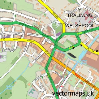
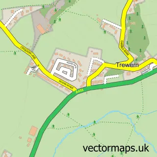
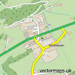
This Guilsfield street map is a detailed vector street map covering a 750m x 750m area. Select a larger area to create and download your own vector street map of Guilsfield.
The 750-metre map sample for Guilsfield covers 292 mapped buildings and approximately 12.8 km of road detail, of which 25 named roads are named. The immediate area includes 1 school, 1 GP surgery and 1 pub. The wider area around Guilsfield features 2 food and drink venues and 1 hotel. To create a larger or custom map of Guilsfield, the map builder lets you define your own coverage area and download editable SVG, PDF and PNG files.
Create a larger editable map of Guilsfield
Choose any area you need and generate a high-quality vector map instantly. Perfect for print, planning, design, business and personal use.

This Guilsfield street map in Powys is available as downloadable SVG, PDF and PNG map files, or as a printed map for planning, business, display, education, local information and design work. You can also create a larger custom map area using the map selector.
What this Guilsfield map sample shows
Guilsfield lies within Guilsfield Community parish, part of Guilsfield ward in the Powys - Powys local authority area. The postcode geography for this area includes the SY postcode area, the SY21 postcode district and the SY21 9 postcode sector. Residents fall under the Powys Teaching Health Board for NHS services.
Local features near Guilsfield
Within 2 milesAmenities and services in and around Guilsfield.
Administrative and postcode information for Guilsfield
Guilsfield lies within Guilsfield Community parish, part of Guilsfield ward in the Powys - Powys local authority area. The postcode geography for this area includes the SY postcode area, the SY21 postcode district and the SY21 9 postcode sector. Residents fall under the Powys Teaching Health Board for NHS services.
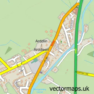
Nearby street map samples around Guilsfield

More street maps in Powys
750 metre map area coverage
Boundary, postcode and point of interest information for the 750m x 750m rectangle centred on this sample map.
Boundaries containing map centre
Constituency: Montgomeryshire and Glyndwr Co Const
District: Powys - Powys
Icb: Powys Teaching
Parish: Guilsfield Community
Police Force: dyfed-powys
Postcode District: SY21
Postcode Sector: SY21 9
Nearby boundaries intersecting sample
Parish: Welshpool Community
Postcode coverage
POI category counts
Sports Club And League: 3
Community Center: 2
Contractor: 2
Convenience Store: 2
Airport Shuttles: 1
Anglican Church: 1
Bar: 1
Building Supply Store: 1
Commercial Industrial: 1
Elementary School: 1
Sample points of interest
- Silver Service Executive Travel
- Parish Church of Saint Aelhaiarn
- The Kings Head
- Owen Willingham Electrical Contractor
- MWMG (Mid Wales Manufacturing Group)
- Guilsfield Community Centre
- Guilsfield Jubilee Hut - new
- ANMAC Construction and Surfacing
- Mike Webster Plasterer
- Guilsfield Local ltd
- Spar
- Guilsfield County Primary School
Create a larger editable map of Guilsfield
This sample shows only a 750 metre area. To create a larger map of Guilsfield, use our map builder to choose your own coverage area, add titles and download editable SVG, PDF and PNG files.
Create a custom map of Guilsfield