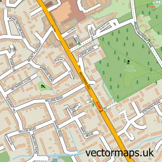
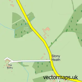
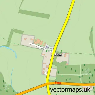
This Hannington street map is a detailed vector street map covering a 750m x 750m area. Select a larger area to create and download your own vector street map of Hannington.
The 750-metre map sample for Hannington covers 98 mapped buildings and approximately 12.5 km of road detail, of which 2 named roads are named. The immediate area includes 1 pub and 1 MOT station within 2 miles. The wider area around Hannington features 1 food and drink venue. To create a larger or custom map of Hannington, the map builder lets you define your own coverage area and download editable SVG, PDF and PNG files.
Create a larger editable map of Hannington
Choose any area you need and generate a high-quality vector map instantly. Perfect for print, planning, design, business and personal use.

This Hannington street map in Hampshire is available as downloadable SVG, PDF and PNG map files, or as a printed map for planning, business, display, education, local information and design work. You can also create a larger custom map area using the map selector.
What this Hannington map sample shows
Hannington lies within Hannington Cp parish, part of Kingsclere ward in the Basingstoke And Deane District (B) local authority area. The postcode geography for this area includes the RG postcode area, the RG26 postcode district and the RG26 5 postcode sector. Residents fall under the Nhs Hampshire And Isle Of Wight Integrated Care Board for NHS services.
Local features near Hannington
Within 2 milesAmenities and services in and around Hannington.
Administrative and postcode information for Hannington
The local authority covering Hannington is Basingstoke And Deane District (B), within the county of Hampshire. The settlement lies within Kingsclere ward and Hannington Cp civil parish. The RG26 postcode district and RG26 5 postcode sector serve the immediate area. NHS provision in the area is delivered through Hampshire Hospitals Nhs Foundation Trust.
Nearby street map samples around Hannington

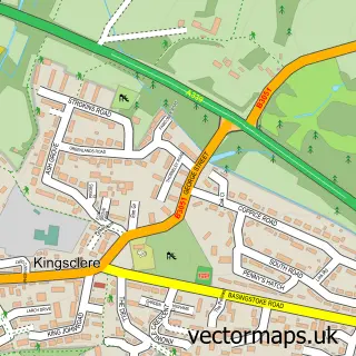
More street maps in Hampshire
750 metre map area coverage
Boundary, postcode and point of interest information for the 750m x 750m rectangle centred on this sample map.
Boundaries containing map centre
Constituency: North West Hampshire Co Const
County: Hampshire County
District: Basingstoke and Deane District (B)
Icb: NHS Hampshire and Isle of Wight ICB
Parish: Hannington CP
Police Force: hampshire
Postcode District: RG26
Postcode Sector: RG26 5
Ward: Tadley North, Kingsclere & Baughurst Ward
Nearby boundaries intersecting sample
No additional intersecting boundaries found.
Postcode coverage
POI category counts
Employment Agencies: 2
Agricultural Service: 1
Arts And Entertainment: 1
Carpenter: 1
Caterer: 1
Church Cathedral: 1
Clothing Store: 1
Equestrian Facility: 1
Fitness Trainer: 1
Professional Services: 1
Sample points of interest
- Vine Craven Hunt Kennels
- Hannington Gallery
- Green Leaf Timber Framers
- The Hannington Kitchen
- All Saints Church
- Cover Up Designs Ltd.
- Beringer Tame
- Hannington Tame
- Inch's Saddlery
- Key Maker Coaching
- Basingstoke Softeners
- The Vine at Hannington
Create a larger editable map of Hannington
This sample shows only a 750 metre area. To create a larger map of Hannington, use our map builder to choose your own coverage area, add titles and download editable SVG, PDF and PNG files.
Create a custom map of Hannington