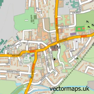
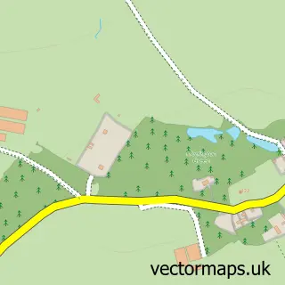
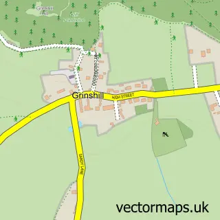
This Harmer Hill street map is a detailed vector street map covering a 750m x 750m area. Select a larger area to create and download your own vector street map of Harmer Hill.
The 750-metre map sample for Harmer Hill covers 199 mapped buildings and approximately 9.4 km of road detail, of which 11 named roads are named. The immediate area includes 3 pubs and 1 MOT station within 2 miles. The wider area around Harmer Hill features 3 food and drink venues and 2 hotels. To create a larger or custom map of Harmer Hill, the map builder lets you define your own coverage area and download editable SVG, PDF and PNG files.
Create a larger editable map of Harmer Hill
Choose any area you need and generate a high-quality vector map instantly. Perfect for print, planning, design, business and personal use.

This Harmer Hill street map in Shropshire is available as downloadable SVG, PDF and PNG map files, or as a printed map for planning, business, display, education, local information and design work. You can also create a larger custom map area using the map selector.
What this Harmer Hill map sample shows
Harmer Hill lies within Myddle, Broughton And Harmer Hill Cp parish, part of The Meres ward in the Shropshire local authority area. The postcode geography for this area includes the SY postcode area, the SY4 postcode district and the SY4 3 postcode sector. Residents fall under the Nhs Shropshire, Telford And Wrekin Integrated Care Board for NHS services.
Local features near Harmer Hill
Within 2 milesAmenities and services in and around Harmer Hill.
Administrative and postcode information for Harmer Hill
Harmer Hill lies within Myddle, Broughton And Harmer Hill Cp parish, part of The Meres ward in the Shropshire local authority area. The postcode geography for this area includes the SY postcode area, the SY4 postcode district and the SY4 3 postcode sector. Residents fall under the Nhs Shropshire, Telford And Wrekin Integrated Care Board for NHS services.
Nearby street map samples around Harmer Hill

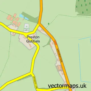
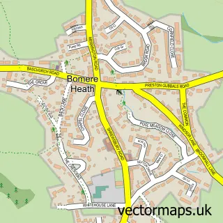
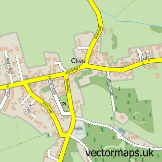
More street maps in Shropshire
750 metre map area coverage
Boundary, postcode and point of interest information for the 750m x 750m rectangle centred on this sample map.
Boundaries containing map centre
Constituency: North Shropshire Co Const
District: Shropshire
Icb: NHS Shropshire Telford and Wrekin ICB
Parish: Myddle, Broughton and Harmer Hill CP
Police Force: west mercia
Postcode District: SY4
Postcode Sector: SY4 3
Nearby boundaries intersecting sample
No additional intersecting boundaries found.
Postcode coverage
POI category counts
Pub: 3
Hotel: 2
Altering And Remodeling Contractor: 1
Arts And Entertainment: 1
Automotive Repair: 1
Bar: 1
Church Cathedral: 1
Financial Service: 1
Physical Therapy: 1
School: 1
Sample points of interest
- Acorn Building Contractors
- Harmer Hill
- Adl mobile mechanic
- Brewers Fayre
- Harmer Hill Chapel
- Lease Finance
- Premier Inn
- Premier Inn Shrewsbury North Harmer Hill
- Shrewsbury Physiotherapy & Orthotics
- Bridgewater Arms
- The Bridgewater Arms
- The Bridgewater Arms
Create a larger editable map of Harmer Hill
This sample shows only a 750 metre area. To create a larger map of Harmer Hill, use our map builder to choose your own coverage area, add titles and download editable SVG, PDF and PNG files.
Create a custom map of Harmer Hill