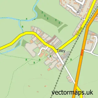
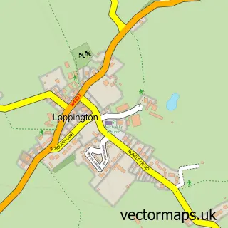
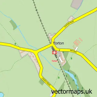
This Wem street map is a detailed vector street map covering a 750m x 750m area. Select a larger area to create and download your own vector street map of Wem.
The 750-metre map sample for Wem covers 382 mapped buildings and approximately 12.7 km of road detail, of which 28 named roads are named. The immediate area includes 1 school, 1 GP surgery within 2 miles, 6 pubs and 3 MOT stations, with 5 within 2 miles. The wider area around Wem features 5 tourism points of interest and 12 food and drink venues. To create a larger or custom map of Wem, the map builder lets you define your own coverage area and download editable SVG, PDF and PNG files.
Create a larger editable map of Wem
Choose any area you need and generate a high-quality vector map instantly. Perfect for print, planning, design, business and personal use.

This Wem street map in Shropshire is available as downloadable SVG, PDF and PNG map files, or as a printed map for planning, business, display, education, local information and design work. You can also create a larger custom map area using the map selector.
What this Wem map sample shows
Wem lies within Wem Urban Cp parish, part of Wem ward in the Shropshire local authority area. The postcode geography for this area includes the SY postcode area, the SY4 postcode district and the SY4 5 postcode sector. Residents fall under the Nhs Shropshire, Telford And Wrekin Integrated Care Board for NHS services.
Local features near Wem
Within 2 milesAmenities and services in and around Wem.
Administrative and postcode information for Wem
Wem lies within Wem Urban Cp parish, part of Wem ward in the Shropshire local authority area. The postcode geography for this area includes the SY postcode area, the SY4 postcode district and the SY4 5 postcode sector. Residents fall under the Nhs Shropshire, Telford And Wrekin Integrated Care Board for NHS services.
Nearby street map samples around Wem

More street maps in Shropshire
750 metre map area coverage
Boundary, postcode and point of interest information for the 750m x 750m rectangle centred on this sample map.
Boundaries containing map centre
Constituency: North Shropshire Co Const
District: Shropshire
Icb: NHS Shropshire Telford and Wrekin ICB
Parish: Wem Urban CP
Police Force: west mercia
Postcode District: SY4
Postcode Sector: SY4 5
Nearby boundaries intersecting sample
No additional intersecting boundaries found.
Postcode coverage
POI category counts
Professional Services: 7
Pub: 6
Beauty Salon: 5
Funeral Services And Cemeteries: 5
Automotive Repair: 4
Cafe: 4
Convenience Store: 4
Elementary School: 4
Flowers And Gifts Shop: 4
Grocery Store: 4
Sample points of interest
- Fresh Clarity Limited
- Fresh Clarity Ltd.
- Tern Mystery Shopping
- Wem St. Peter and St. Paul
- Embassy Bar Shopfitters
- Shropshire Phone Repairs LTD
- Soul Bird Gallery
- Warwick-Wright Restorations
- Roseville House
- Midcounties Co-Op Wem, Shopping Park
- Millennium Green Wem
- Fatboy Sound
Create a larger editable map of Wem
This sample shows only a 750 metre area. To create a larger map of Wem, use our map builder to choose your own coverage area, add titles and download editable SVG, PDF and PNG files.
Create a custom map of Wem