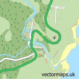
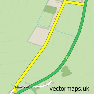
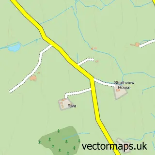
This Helmsdale street map is a detailed vector street map covering a 750m x 750m area. Select a larger area to create and download your own vector street map of Helmsdale.
The 750-metre map sample for Helmsdale covers 110 mapped buildings and approximately 15.0 km of road detail, of which 14 named roads are named. The immediate area includes 1 pub and 1 MOT station within 2 miles. The wider area around Helmsdale features 2 tourism points of interest, 1 food and drink venue and 6 hotels. To create a larger or custom map of Helmsdale, the map builder lets you define your own coverage area and download editable SVG, PDF and PNG files.
Create a larger editable map of Helmsdale
Choose any area you need and generate a high-quality vector map instantly. Perfect for print, planning, design, business and personal use.

This Helmsdale street map in Sutherland is available as downloadable SVG, PDF and PNG map files, or as a printed map for planning, business, display, education, local information and design work. You can also create a larger custom map area using the map selector.
What this Helmsdale map sample shows
Helmsdale lies within Highland parish, part of East Sutherland And Edderton ward in the Highland local authority area. The postcode geography for this area includes the KW postcode area, the KW8 postcode district and the KW8 6 postcode sector. Residents fall under the Highland for NHS services.
Local features near Helmsdale
Within 2 milesAmenities and services in and around Helmsdale.
Administrative and postcode information for Helmsdale
The local authority covering Helmsdale is Highland, within the county of Sutherland. The settlement lies within East Sutherland And Edderton ward and Highland civil parish. The KW8 postcode district and KW8 6 postcode sector serve the immediate area. NHS provision in the area is delivered through Highland.
Nearby street map samples around Helmsdale

More street maps in Sutherland
750 metre map area coverage
Boundary, postcode and point of interest information for the 750m x 750m rectangle centred on this sample map.
Boundaries containing map centre
Constituency: Caithness, Sutherland and Easter Ross Co Const
District: Highland
Icb: Highland
Postcode District: KW8
Postcode Sector: KW8 6
Ward: East Sutherland and Edderton Ward
Nearby boundaries intersecting sample
No additional intersecting boundaries found.
Postcode coverage
POI category counts
Hotel: 6
Convenience Store: 4
Automotive Repair: 2
Bed And Breakfast: 2
Community Services Non Profits: 2
Doctor: 2
Inn: 2
Seafood Restaurant: 2
Shipping Center: 2
Antique Store: 1
Sample points of interest
- Gilberts of Helmsdale
- Anne Little - Artist
- Helmie Autoshine
- E M & T Rapson
- EM&T Rapson
- Bank of Scotland
- Community Banker Helmsdale Community Centre
- Helmsdale Castle Beach
- Kindale House
- The Bridge Guest House, Helmsdale
- Central and East Sutherland
- Helmsdale
Create a larger editable map of Helmsdale
This sample shows only a 750 metre area. To create a larger map of Helmsdale, use our map builder to choose your own coverage area, add titles and download editable SVG, PDF and PNG files.
Create a custom map of Helmsdale