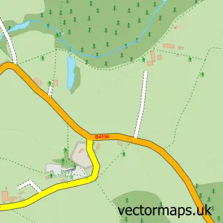
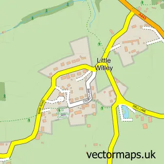
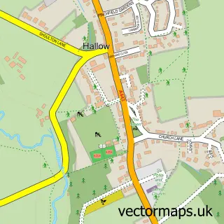
This Holt Heath street map is a detailed vector street map covering a 750m x 750m area. Select a larger area to create and download your own vector street map of Holt Heath.
The 750-metre map sample for Holt Heath covers 121 mapped buildings and approximately 30.4 km of road detail, of which 8 named roads are named. The immediate area includes 1 GP surgery within 2 miles, 1 pub and 2 MOT stations within 2 miles. The wider area around Holt Heath features 1 food and drink venue and 1 campsite within 2 miles. To create a larger or custom map of Holt Heath, the map builder lets you define your own coverage area and download editable SVG, PDF and PNG files.
Create a larger editable map of Holt Heath
Choose any area you need and generate a high-quality vector map instantly. Perfect for print, planning, design, business and personal use.

This Holt Heath street map in Worcestershire is available as downloadable SVG, PDF and PNG map files, or as a printed map for planning, business, display, education, local information and design work. You can also create a larger custom map area using the map selector.
What this Holt Heath map sample shows
Holt Heath lies within Holt Cp parish, part of Baldwin ward in the Malvern Hills District local authority area. The postcode geography for this area includes the WR postcode area, the WR6 postcode district and the WR6 6 postcode sector. Residents fall under the Nhs Herefordshire And Worcestershire Integrated Care Board for NHS services.
Local features near Holt Heath
Within 2 milesAmenities and services in and around Holt Heath.
Administrative and postcode information for Holt Heath
Holt Heath lies within Holt Cp parish, part of Baldwin ward in the Malvern Hills District local authority area. The postcode geography for this area includes the WR postcode area, the WR6 postcode district and the WR6 6 postcode sector. Residents fall under the Nhs Herefordshire And Worcestershire Integrated Care Board for NHS services.
Nearby street map samples around Holt Heath

More street maps in Worcestershire
750 metre map area coverage
Boundary, postcode and point of interest information for the 750m x 750m rectangle centred on this sample map.
Boundaries containing map centre
Constituency: West Worcestershire Co Const
County: Worcestershire County
District: Malvern Hills District
Icb: NHS Herefordshire and Worcestershire ICB
Parish: Holt CP
Police Force: west mercia
Postcode District: WR6
Postcode Sector: WR6 6
Ward: Hallow & Holt Ward
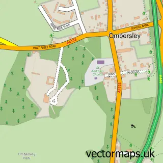
Nearby boundaries intersecting sample
Constituency: Droitwich and Evesham Co Const
District: Wychavon District
Parish: Ombersley CP
Ward: Ombersley Ward
Postcode coverage
POI category counts
Business Management Services: 2
Farm: 2
Farmers Market: 2
Caterer: 1
Day Care Preschool: 1
Fishing Club: 1
Pest Control Service: 1
Post Office: 1
Pub: 1
Public And Government Association: 1
Sample points of interest
- Holt Heath Post Office
- Post Office
- Barflies Licenced Bars
- Little Squirrels Ltd
- Broomfields farm shop
- Harper Farming
- Broomfields of Holt
- SHM Broomfield & Son
- Old Church Lakes
- Martley Electronics
- Cottage Store & Post Office Holt Heath
- The Red Lion
Create a larger editable map of Holt Heath
This sample shows only a 750 metre area. To create a larger map of Holt Heath, use our map builder to choose your own coverage area, add titles and download editable SVG, PDF and PNG files.
Create a custom map of Holt Heath