Vector Maps logo
Home Why it works Popular maps Districts Samples Customizer Create Your Map
VectorMaps.uk
Home Popular maps Districts Samples Customizer Create Your Map Privacy Disclaimer
Home / UK Maps / Aberdeenshire / Inverallochy Map

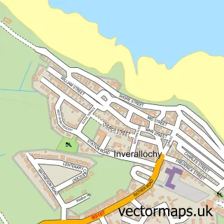
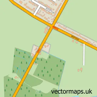
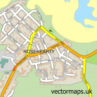
This Inverallochy street map is a detailed vector street map covering a 750m x 750m area. Select a larger area to create and download your own vector street map of Inverallochy.

Inverallochy is a village in Aberdeenshire, in the North East Scotland of Scotland. The settlement falls within the Banff And Buchan parliamentary constituency. It is served by the AB43 postcode district, with AB43 8 as the local postcode sector.

The 750-metre map sample for Inverallochy covers 149 mapped buildings and approximately 17.2 km of road detail, of which 21 named roads are named. To create a larger or custom map of Inverallochy, the map builder lets you define your own coverage area and download editable SVG, PDF and PNG files.

149Buildings
17.19 kmRoads
21Named roads
0Residents within 2 miles
Create your own

Create a larger editable map of Inverallochy

Choose any area you need and generate a high-quality vector map instantly. Perfect for print, planning, design, business and personal use.

Choose any location
Editable SVG files
Any size up to A0
PDF, PNG & more
Instant download
High quality guaranteed
Create My Custom Map
Secure, private & no credit card required
Inverallochy Vector Street Map
750m Sample
Inverallochy vector street map sample showing roads, buildings and local features in a 750 metre preview area
Buy Inverallochy Map Print from £12.95 Buy Inverallochy Digital Map from £6

This Inverallochy street map in Aberdeenshire is available as downloadable SVG, PDF and PNG map files, or as a printed map for planning, business, display, education, local information and design work. You can also create a larger custom map area using the map selector.

What this Inverallochy map sample shows

Inverallochy lies within Aberdeenshire parish, part of Fraserburgh And District ward in the Aberdeenshire local authority area. The postcode geography for this area includes the AB postcode area, the AB43 postcode district and the AB43 8 postcode sector. Residents fall under the Grampian for NHS services.

Administrative and postcode information for Inverallochy

The local authority covering Inverallochy is Aberdeenshire, within the county of Aberdeenshire. The settlement lies within Fraserburgh And District ward and Aberdeenshire civil parish. The AB43 postcode district and AB43 8 postcode sector serve the immediate area. NHS provision in the area is delivered through Grampian.

Parish ABERDEENSHIRE
Ward Fraserburgh and District
District / local authority Aberdeenshire
County Aberdeenshire
Historic county Aberdeenshire
Postcode district AB43
Postcode sector AB43 8
Parliamentary constituency Banff and Buchan
Region North East Scotland
Country Scotland

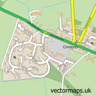
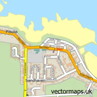
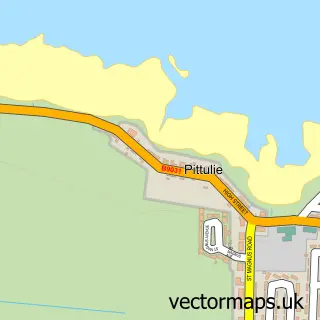
Nearby street map samples around Inverallochy

Street map sample of Fraserburgh, Aberdeenshire Fraserburgh Town - Aberdeenshire - 3.1 miles Street map sample of Aberdeen, City of Aberdeen Aberdeen City - City of Aberdeen - 36.9 miles Street map sample of Cairnbulg, Aberdeenshire Cairnbulg Village - Aberdeenshire - 0.2 miles Street map sample of St Combs, Aberdeenshire St Combs Village - Aberdeenshire - 1.4 miles Street map sample of Rathen, Aberdeenshire Rathen Village - Aberdeenshire - 3.7 miles Street map sample of Memsie, Aberdeenshire Memsie Village - Aberdeenshire - 4.8 miles Street map sample of Crimond, Aberdeenshire Crimond Village - Aberdeenshire - 5.2 miles Street map sample of Sandhaven, Aberdeenshire Sandhaven Village - Aberdeenshire - 5.2 miles Street map sample of Pittulie, Aberdeenshire Pittulie Village - Aberdeenshire - 5.5 miles Street map sample of Rosehearty, Aberdeenshire Rosehearty Village - Aberdeenshire - 7.0 miles

More street maps in Aberdeenshire

Street map sample of Cairnbulg, Aberdeenshire Cairnbulg Village - 0.2 miles Street map sample of St Combs, Aberdeenshire St Combs Village - 1.4 miles Street map sample of Fraserburgh, Aberdeenshire Fraserburgh Town - 3.1 miles Street map sample of Rathen, Aberdeenshire Rathen Village - 3.7 miles Street map sample of Memsie, Aberdeenshire Memsie Village - 4.8 miles

750 metre map area coverage

Boundary, postcode and point of interest information for the 750m x 750m rectangle centred on this sample map.

Boundaries containing map centre

Constituency: Aberdeenshire North and Moray East Co Const

District: Aberdeenshire

Icb: Grampian

Postcode District: AB43

Postcode Sector: AB43 8

Ward: Fraserburgh and District Ward

Nearby boundaries intersecting sample

No additional intersecting boundaries found.

Postcode coverage

AB43 AB43 8

POI category counts

Convenience Store: 5

Library: 3

Holiday Rental Home: 2

Beach: 1

Beauty Salon: 1

Business: 1

Catholic Church: 1

Community Center: 1

Currency Exchange: 1

Elementary School: 1

Sample points of interest

  • Inverallochy Beach Beach
  • Treat Company Beauty Salon
  • Lodge Security Services Ltd Business
  • Inverallochy and Rathen East Catholic Church
  • Invercairn Community Hall Community Center
  • Cairnbulg Post Office Convenience Store
  • Loco & Post Office Convenience Store
  • Londis Convenience Store
  • Post Office-Cairnbulg Convenience Store
  • Premier Mario's Convenience Store
  • Post Office Travel Money Currency Exchange
  • Inverallochy School Elementary School

Create a larger editable map of Inverallochy

This sample shows only a 750 metre area. To create a larger map of Inverallochy, use our map builder to choose your own coverage area, add titles and download editable SVG, PDF and PNG files.

Create a custom map of Inverallochy

Phone 01751 473136 | Copyright Vectormaps.uk 2026

Samples Customizer Privacy Disclaimer
Inverallochy Vector Street Map
Inverallochy enlarged street map sample showing a 750 metre preview area