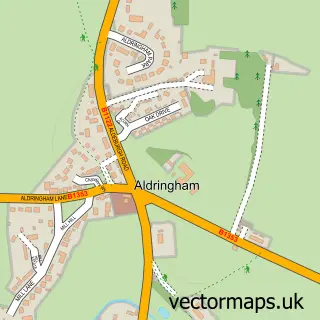
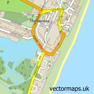
This Leiston street map is a detailed vector street map covering a 750m x 750m area. Select a larger area to create and download your own vector street map of Leiston.
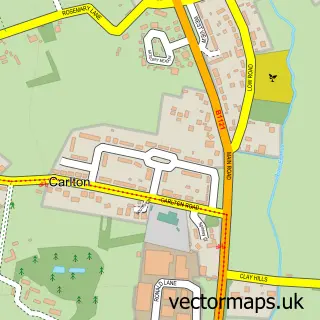
The 750-metre map sample for Leiston covers 572 mapped buildings and approximately 17.0 km of road detail, of which 40 named roads are named. The immediate area includes 1 school, 1 GP surgery, 3 pubs and 1 MOT station, with 5 within 2 miles. The wider area around Leiston features 6 tourism points of interest, 7 food and drink venues and 3 hotels. To create a larger or custom map of Leiston, the map builder lets you define your own coverage area and download editable SVG, PDF and PNG files.
Create a larger editable map of Leiston
Choose any area you need and generate a high-quality vector map instantly. Perfect for print, planning, design, business and personal use.

This Leiston street map in Suffolk is available as downloadable SVG, PDF and PNG map files, or as a printed map for planning, business, display, education, local information and design work. You can also create a larger custom map area using the map selector.
What this Leiston map sample shows
Leiston lies within Leiston Cp parish, part of Aldeburgh & Leiston ward in the East Suffolk District local authority area. The postcode geography for this area includes the IP postcode area, the IP16 postcode district and the IP16 4 postcode sector. Residents fall under the Nhs Suffolk And North East Essex Integrated Care Board for NHS services.
Local features near Leiston
Within 2 milesAmenities and services in and around Leiston.
Administrative and postcode information for Leiston
The local authority covering Leiston is East Suffolk District, within the county of Suffolk. The settlement lies within Aldeburgh & Leiston ward and Leiston Cp civil parish. The IP16 postcode district and IP16 4 postcode sector serve the immediate area. NHS provision in the area is delivered through East Suffolk And North Essex Nhs Foundation Trust.
Nearby street map samples around Leiston

More street maps in Suffolk
750 metre map area coverage
Boundary, postcode and point of interest information for the 750m x 750m rectangle centred on this sample map.
Boundaries containing map centre
Constituency: Suffolk Coastal Co Const
County: Suffolk County
District: East Suffolk District
Icb: NHS Essex ICB
Parish: Leiston CP
Police Force: suffolk
Postcode District: IP16
Postcode Sector: IP16 4
Ward: Aldeburgh & Leiston Ward
Nearby boundaries intersecting sample
No additional intersecting boundaries found.
Postcode coverage
POI category counts
Convenience Store: 5
Arts And Entertainment: 4
Beauty Salon: 4
Bed And Breakfast: 4
Community Services Non Profits: 4
Arts And Crafts: 3
Banks: 3
Bar: 3
Barber: 3
Chinese Restaurant: 3
Sample points of interest
- Rescue Paws
- Molly's Trading Post and Clearances
- Sue Ryder
- Simon Merrett Architects Ltd.
- Simon Merrett Architects
- Chris Newson Framing Shop And Art Gallery
- Carolyn
- Katie's Pottery Studio
- Sandlings
- Cipher Crystal
- Paint Pots
- Sizewell Illustration Club Limited
Create a larger editable map of Leiston
This sample shows only a 750 metre area. To create a larger map of Leiston, use our map builder to choose your own coverage area, add titles and download editable SVG, PDF and PNG files.
Create a custom map of Leiston