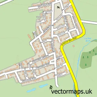
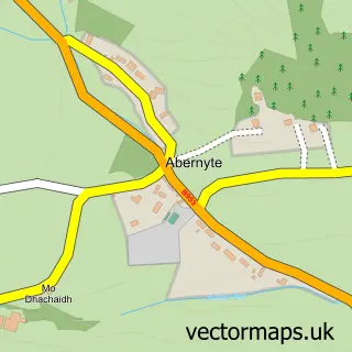
This Longforgan street map is a detailed vector street map covering a 750m x 750m area. Select a larger area to create and download your own vector street map of Longforgan.
The 750-metre map sample for Longforgan covers 103 mapped buildings and approximately 13.1 km of road detail, of which 11 named roads are named. To create a larger or custom map of Longforgan, the map builder lets you define your own coverage area and download editable SVG, PDF and PNG files.
Create a larger editable map of Longforgan
Choose any area you need and generate a high-quality vector map instantly. Perfect for print, planning, design, business and personal use.

This Longforgan street map in Perth and Kinross is available as downloadable SVG, PDF and PNG map files, or as a printed map for planning, business, display, education, local information and design work. You can also create a larger custom map area using the map selector.
What this Longforgan map sample shows
Longforgan lies within Perth And Kinross parish, part of Carse Of Gowrie ward in the Perth And Kinross local authority area. The postcode geography for this area includes the DD postcode area, the DD2 postcode district and the DD2 5 postcode sector. Residents fall under the Tayside for NHS services.
Administrative and postcode information for Longforgan
The local authority covering Longforgan is Perth And Kinross, within the county of Perth And Kinross. The settlement lies within Carse Of Gowrie ward and Perth And Kinross civil parish. The DD2 postcode district and DD2 5 postcode sector serve the immediate area. NHS provision in the area is delivered through Tayside.
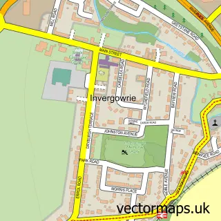
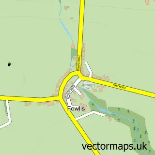
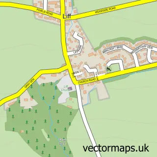
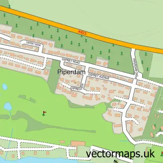
Nearby street map samples around Longforgan

More street maps in Perth and Kinross
750 metre map area coverage
Boundary, postcode and point of interest information for the 750m x 750m rectangle centred on this sample map.
Boundaries containing map centre
Constituency: Perth and Kinross-shire Co Const
District: Perth and Kinross
Icb: Tayside
Postcode District: DD2
Postcode Sector: DD2 5
Ward: Carse of Gowrie Ward
Nearby boundaries intersecting sample
No additional intersecting boundaries found.
Postcode coverage
POI category counts
Elementary School: 2
Shipping Center: 2
Bar: 1
Building Supply Store: 1
Church Cathedral: 1
Convenience Store: 1
Currency Exchange: 1
Grocery Store: 1
Hotel Bar: 1
Inn: 1
Sample points of interest
- Golden Rays tavern
- Regent Plumbing Services
- Longforgan Church
- Premier Premier Village Store
- Post Office Travel Money
- Longforgan Primary School
- Longforgan Primary School
- Longforgan Newsagents & General Store
- The Longforgan Coaching Inn
- Longforgan Coaching Inn
- TSG UK Solutions Ltd.
- Aquamac Plumbing and Heating
Create a larger editable map of Longforgan
This sample shows only a 750 metre area. To create a larger map of Longforgan, use our map builder to choose your own coverage area, add titles and download editable SVG, PDF and PNG files.
Create a custom map of Longforgan