This Manton street map is a detailed vector street map covering a 750m x 750m area. Select a larger area to create and download your own vector street map of Manton.
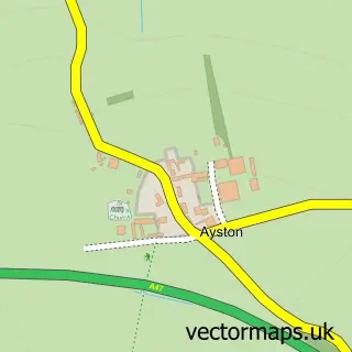
The 750-metre map sample for Manton covers 141 mapped buildings and approximately 13.8 km of road detail, of which 10 named roads are named. The immediate area includes 1 pub. The wider area around Manton features 2 food and drink venues. To create a larger or custom map of Manton, the map builder lets you define your own coverage area and download editable SVG, PDF and PNG files.
Create a larger editable map of Manton
Choose any area you need and generate a high-quality vector map instantly. Perfect for print, planning, design, business and personal use.

This Manton street map in Rutland is available as downloadable SVG, PDF and PNG map files, or as a printed map for planning, business, display, education, local information and design work. You can also create a larger custom map area using the map selector.
What this Manton map sample shows
Manton lies within Manton Cp parish, part of Braunston & Martinsthorpe ward in the Rutland local authority area. The postcode geography for this area includes the LE postcode area, the LE15 postcode district and the LE15 8 postcode sector. Residents fall under the Nhs Leicester, Leicestershire And Rutland Integrated Care Board for NHS services.
Local features near Manton
Within 2 milesAmenities and services in and around Manton.
Administrative and postcode information for Manton
Manton lies within Manton Cp parish, part of Braunston & Martinsthorpe ward in the Rutland local authority area. The postcode geography for this area includes the LE postcode area, the LE15 postcode district and the LE15 8 postcode sector. Residents fall under the Nhs Leicester, Leicestershire And Rutland Integrated Care Board for NHS services.
Nearby street map samples around Manton

More street maps in Rutland
750 metre map area coverage
Boundary, postcode and point of interest information for the 750m x 750m rectangle centred on this sample map.
Boundaries containing map centre
Constituency: Rutland and Stamford Co Const
District: Rutland
Icb: NHS Leicester Leicestershire and Rutland ICB
Parish: Manton CP
Police Force: leicestershire
Postcode District: LE15
Postcode Sector: LE15 8
Ward: Braunston & Martinsthorpe Ward
Nearby boundaries intersecting sample
No additional intersecting boundaries found.
Postcode coverage
POI category counts
Active Life: 1
Anglican Church: 1
Cafe: 1
Community Center: 1
Computer Store: 1
Contractor: 1
Dance School: 1
Diagnostic Imaging: 1
Fitness Trainer: 1
Flooring Contractors: 1
Sample points of interest
- Rutland Water Cycle Route
- Manton: St Mary
- Rutland Nursery
- Manton Village Hall
- Midlands Cabling & IT Services
- English Limestone Company
- Launch Academy of Dance
- Croft Medical Imaging Ltd.
- Inspire2tri
- All Seasons Cleaning Services
- Sacker Carpentry and Joinery
- Genus Design
Create a larger editable map of Manton
This sample shows only a 750 metre area. To create a larger map of Manton, use our map builder to choose your own coverage area, add titles and download editable SVG, PDF and PNG files.
Create a custom map of Manton