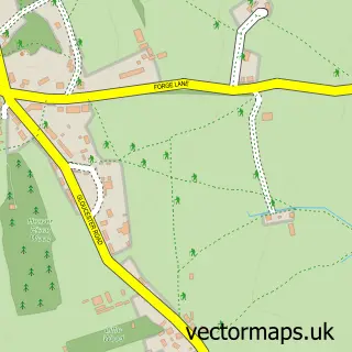
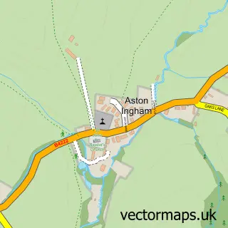
This Newent street map is a detailed vector street map covering a 750m x 750m area. Select a larger area to create and download your own vector street map of Newent.
The 750-metre map sample for Newent covers 551 mapped buildings and approximately 64.6 km of road detail, of which 45 named roads are named. The immediate area includes 1 GP surgery, 4 pubs and 3 MOT stations within 2 miles. The wider area around Newent features 6 tourism points of interest, 7 food and drink venues and 1 hotel. To create a larger or custom map of Newent, the map builder lets you define your own coverage area and download editable SVG, PDF and PNG files.
Create a larger editable map of Newent
Choose any area you need and generate a high-quality vector map instantly. Perfect for print, planning, design, business and personal use.

This Newent street map in Gloucestershire is available as downloadable SVG, PDF and PNG map files, or as a printed map for planning, business, display, education, local information and design work. You can also create a larger custom map area using the map selector.
What this Newent map sample shows
Newent lies within Newent Cp parish, part of Newent & Taynton ward in the Forest Of Dean District local authority area. The postcode geography for this area includes the GL postcode area, the GL18 postcode district and the GL18 1 postcode sector. Residents fall under the Nhs Gloucestershire Integrated Care Board for NHS services.
Local features near Newent
Within 2 milesAmenities and services in and around Newent.
Administrative and postcode information for Newent
Newent lies within Newent Cp parish, part of Newent & Taynton ward in the Forest Of Dean District local authority area. The postcode geography for this area includes the GL postcode area, the GL18 postcode district and the GL18 1 postcode sector. Residents fall under the Nhs Gloucestershire Integrated Care Board for NHS services.
Nearby street map samples around Newent


More street maps in Gloucestershire
750 metre map area coverage
Boundary, postcode and point of interest information for the 750m x 750m rectangle centred on this sample map.
Boundaries containing map centre
Constituency: Forest of Dean Co Const
County: Gloucestershire County
District: Forest of Dean District
Icb: NHS Gloucestershire ICB
Parish: Newent CP
Police Force: gloucestershire
Postcode District: GL18
Postcode Sector: GL18 1
Ward: Newent & Taynton Ward
Nearby boundaries intersecting sample
No additional intersecting boundaries found.
Postcode coverage
POI category counts
Hair Salon: 6
Retail: 6
Convenience Store: 5
Flowers And Gifts Shop: 4
Pub: 4
Real Estate Agent: 4
Art Gallery: 3
Beauty Salon: 3
Charity Organization: 3
Church Cathedral: 3
Sample points of interest
- Stunt Drive UK
- St Mary the Virgin Newent
- Jillings Antique Clocks
- Giltedge Woodburner Installations
- Cowdy Gallery
- Rhythm and Vine Art Gallery
- The Secret Gallery
- The Wool Garden
- Rogan Josh's Indian Takeaway
- Smiths Auctions
- Crusty Loaf
- Wilson’s
Create a larger editable map of Newent
This sample shows only a 750 metre area. To create a larger map of Newent, use our map builder to choose your own coverage area, add titles and download editable SVG, PDF and PNG files.
Create a custom map of Newent