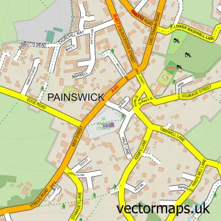
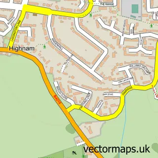
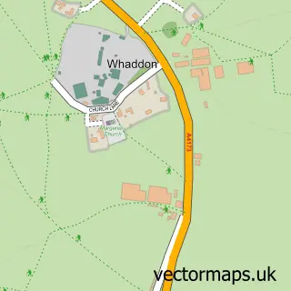
This Gloucester street map is a detailed vector street map covering a 750m x 750m area. Select a larger area to create and download your own vector street map of Gloucester.
The 750-metre map sample for Gloucester covers 212 mapped buildings and approximately 60.4 km of road detail, of which 57 named roads are named. The immediate area includes 1 school, 8 GP surgeries within 2 miles, 27 pubs and 2 MOT stations, with 37 within 2 miles. The wider area around Gloucester features 22 tourism points of interest, 78 food and drink venues and 6 hotels. To create a larger or custom map of Gloucester, the map builder lets you define your own coverage area and download editable SVG, PDF and PNG files.
Create a larger editable map of Gloucester
Choose any area you need and generate a high-quality vector map instantly. Perfect for print, planning, design, business and personal use.

This Gloucester street map in Gloucestershire is available as downloadable SVG, PDF and PNG map files, or as a printed map for planning, business, display, education, local information and design work. You can also create a larger custom map area using the map selector.
What this Gloucester map sample shows
Gloucester lies within Gloucestershire County parish, part of Westgate ward in the Gloucester District (B) local authority area. The postcode geography for this area includes the GL postcode area, the GL2 postcode district and the GL2 5 postcode sector. Residents fall under the Nhs Gloucestershire Integrated Care Board for NHS services.
Local features near Gloucester
Within 2 milesAmenities and services in and around Gloucester.
Administrative and postcode information for Gloucester
The local authority covering Gloucester is Gloucester District (B), within the county of Gloucestershire. The settlement lies within Westgate ward and Gloucestershire County civil parish. The GL2 postcode district and GL2 5 postcode sector serve the immediate area. NHS provision in the area is delivered through Gloucestershire Hospitals Nhs Foundation Trust.
Nearby street map samples around Gloucester
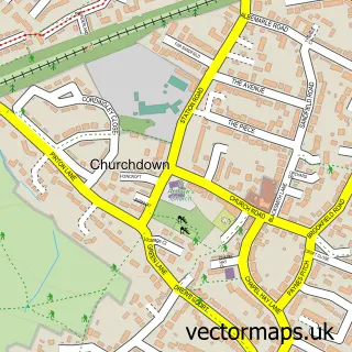
More street maps in Gloucestershire
750 metre map area coverage
Boundary, postcode and point of interest information for the 750m x 750m rectangle centred on this sample map.
Boundaries containing map centre
Constituency: Gloucester Boro Const
County: Gloucestershire County
District: Gloucester District (B)
Icb: NHS Gloucestershire ICB
Police Force: gloucestershire
Postcode District: GL1
Postcode Sector: GL1 1
Ward: Westgate Ward
Nearby boundaries intersecting sample
Postcode Sector: GL1 2, GL1 3
Ward: Kingsholm & Wotton Ward
Postcode coverage
POI category counts
Beauty Salon: 29
Pub: 27
Hair Salon: 26
Jewelry Store: 26
Employment Agencies: 24
Professional Services: 21
Cafe: 20
Restaurant: 17
Charity Organization: 15
Clothing Store: 15
Sample points of interest
- Cityheart Living Student Accommodation
- Fleece Hotel
- Upper Quay House
- MBS Accountants
- Forest of Dean Military Vehicle Driving Centre
- Chinese Medical Centre
- Enza Marketing
- Punchline Gloucester
- The Destination Marketing Group
- The Chinese Medical Centre
- Gloucester Indoor Bowls Club
- Tnt Gloucester's Original Party Venue
Create a larger editable map of Gloucester
This sample shows only a 750 metre area. To create a larger map of Gloucester, use our map builder to choose your own coverage area, add titles and download editable SVG, PDF and PNG files.
Create a custom map of Gloucester