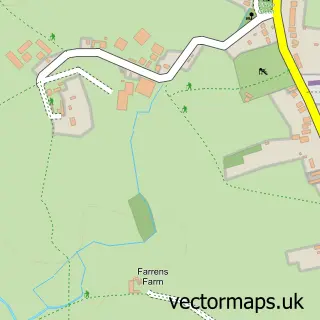
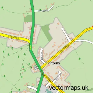
This Maisemore street map is a detailed vector street map covering a 750m x 750m area. Select a larger area to create and download your own vector street map of Maisemore.
The 750-metre map sample for Maisemore covers 188 mapped buildings and approximately 33.0 km of road detail, of which 10 named roads are named. The immediate area includes 3 GP surgeries within 2 miles, 1 pub and 10 MOT stations within 2 miles. The wider area around Maisemore features 2 food and drink venues and 1 hotel. To create a larger or custom map of Maisemore, the map builder lets you define your own coverage area and download editable SVG, PDF and PNG files.
Create a larger editable map of Maisemore
Choose any area you need and generate a high-quality vector map instantly. Perfect for print, planning, design, business and personal use.

This Maisemore street map in Gloucestershire is available as downloadable SVG, PDF and PNG map files, or as a printed map for planning, business, display, education, local information and design work. You can also create a larger custom map area using the map selector.
What this Maisemore map sample shows
Maisemore lies within Maisemore Cp parish, part of Highnam With Haw Bridge ward in the Tewkesbury District (B) local authority area. The postcode geography for this area includes the GL postcode area, the GL2 postcode district and the GL2 8 postcode sector. Residents fall under the Nhs Gloucestershire Integrated Care Board for NHS services.
Local features near Maisemore
Within 2 milesAmenities and services in and around Maisemore.
Administrative and postcode information for Maisemore
Maisemore lies within Maisemore Cp parish, part of Highnam With Haw Bridge ward in the Tewkesbury District (B) local authority area. The postcode geography for this area includes the GL postcode area, the GL2 postcode district and the GL2 8 postcode sector. Residents fall under the Nhs Gloucestershire Integrated Care Board for NHS services.
Nearby street map samples around Maisemore

More street maps in Gloucestershire
750 metre map area coverage
Boundary, postcode and point of interest information for the 750m x 750m rectangle centred on this sample map.
Boundaries containing map centre
Constituency: Forest of Dean Co Const
County: Gloucestershire County
District: Tewkesbury District (B)
Icb: NHS Gloucestershire ICB
Parish: Maisemore CP
Police Force: gloucestershire
Postcode District: GL2
Postcode Sector: GL2 8
Ward: Highnam with Haw Bridge Ward
Nearby boundaries intersecting sample
No additional intersecting boundaries found.
Postcode coverage
POI category counts
Financial Advising: 3
Marketing Agency: 3
Church Cathedral: 2
Employment Agencies: 2
Event Photography: 2
Event Planning: 2
Land Surveying: 2
Advertising Agency: 1
Antenna Service: 1
Bridal Shop: 1
Sample points of interest
- Dark Horse Agency
- Steve Unett Aerials
- LJ Bridal Collection
- Practical Roofing
- Penderels Trust
- Maisemore Church
- West of Severn Churches
- Maisemore Village Hall
- Precious Hands SEND Support and Therapies
- Ace Sales Recruitment
- Ashley Associates UK
- Bexcopter
Create a larger editable map of Maisemore
This sample shows only a 750 metre area. To create a larger map of Maisemore, use our map builder to choose your own coverage area, add titles and download editable SVG, PDF and PNG files.
Create a custom map of Maisemore