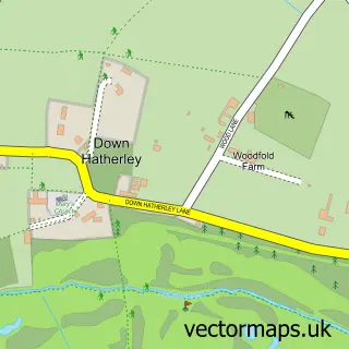
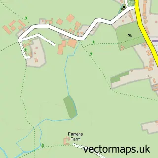
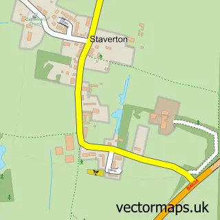
This Twigworth street map is a detailed vector street map covering a 750m x 750m area. Select a larger area to create and download your own vector street map of Twigworth.
The 750-metre map sample for Twigworth covers 345 mapped buildings and approximately 24.8 km of road detail, of which 6 named roads are named. The immediate area includes 1 GP surgery within 2 miles and 4 MOT stations within 2 miles. The wider area around Twigworth features 2 tourism points of interest and 1 campsite within 2 miles. To create a larger or custom map of Twigworth, the map builder lets you define your own coverage area and download editable SVG, PDF and PNG files.
Create a larger editable map of Twigworth
Choose any area you need and generate a high-quality vector map instantly. Perfect for print, planning, design, business and personal use.

This Twigworth street map in Gloucestershire is available as downloadable SVG, PDF and PNG map files, or as a printed map for planning, business, display, education, local information and design work. You can also create a larger custom map area using the map selector.
What this Twigworth map sample shows
Twigworth lies within Down Hatherley Cp parish, part of Severn Vale South ward in the Tewkesbury District (B) local authority area. The postcode geography for this area includes the GL postcode area, the GL2 postcode district and the GL2 9 postcode sector. Residents fall under the Nhs Gloucestershire Integrated Care Board for NHS services.
Local features near Twigworth
Within 2 milesAmenities and services in and around Twigworth.
Administrative and postcode information for Twigworth
The local authority covering Twigworth is Tewkesbury District (B), within the county of Gloucestershire. The settlement lies within Severn Vale South ward and Down Hatherley Cp civil parish. The GL2 postcode district and GL2 9 postcode sector serve the immediate area. NHS provision in the area is delivered through Gloucestershire Hospitals Nhs Foundation Trust.
Nearby street map samples around Twigworth

More street maps in Gloucestershire
750 metre map area coverage
Boundary, postcode and point of interest information for the 750m x 750m rectangle centred on this sample map.
Boundaries containing map centre
Constituency: Tewkesbury Co Const
County: Gloucestershire County
District: Tewkesbury District (B)
Icb: NHS Gloucestershire ICB
Parish: Twigworth CP
Police Force: gloucestershire
Postcode District: GL2
Postcode Sector: GL2 9
Ward: Innsworth Ward
Nearby boundaries intersecting sample
Parish: Down Hatherley CP
Ward: Severn Vale South Ward
Postcode coverage
POI category counts
Campground: 2
Contractor: 2
Pets: 2
Car Wash: 1
Computer Hardware Company: 1
Convenience Store: 1
Corporate Office: 1
Education: 1
Employment Agencies: 1
Gas Station: 1
Sample points of interest
- Court Farm Camping
- Pine View Parks
- NSGL Parking
- Barewood Buildings
- The Cotswold Cabin Company
- Total Driveways & Patios
- Your Coop Food
- Red E2
- Gloucestershire Enterprise Limited - GEL
- Ivy Resource Group Ltd.
- Co-op
- Z's Beautique
Create a larger editable map of Twigworth
This sample shows only a 750 metre area. To create a larger map of Twigworth, use our map builder to choose your own coverage area, add titles and download editable SVG, PDF and PNG files.
Create a custom map of Twigworth