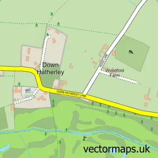
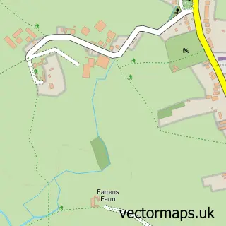
This Norton street map is a detailed vector street map covering a 750m x 750m area. Select a larger area to create and download your own vector street map of Norton.
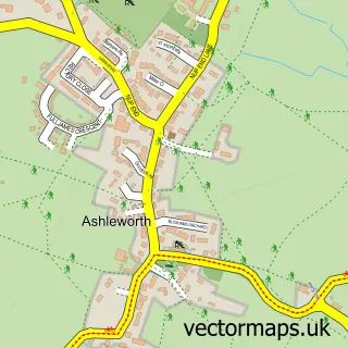
The 750-metre map sample for Norton covers 135 mapped buildings and approximately 19.3 km of road detail, of which 5 named roads are named. The immediate area includes 1 school, 1 pub and 3 MOT stations within 2 miles. The wider area around Norton features 1 tourism point of interest, 1 food and drink venue and 1 campsite within 2 miles. To create a larger or custom map of Norton, the map builder lets you define your own coverage area and download editable SVG, PDF and PNG files.
Create a larger editable map of Norton
Choose any area you need and generate a high-quality vector map instantly. Perfect for print, planning, design, business and personal use.

This Norton street map in Gloucestershire is available as downloadable SVG, PDF and PNG map files, or as a printed map for planning, business, display, education, local information and design work. You can also create a larger custom map area using the map selector.
What this Norton map sample shows
Norton lies within Norton Cp parish, part of Severn Vale South ward in the Tewkesbury District (B) local authority area. The postcode geography for this area includes the GL postcode area, the GL2 postcode district and the GL2 9 postcode sector. Residents fall under the Nhs Gloucestershire Integrated Care Board for NHS services.
Local features near Norton
Within 2 milesAmenities and services in and around Norton.
Administrative and postcode information for Norton
The local authority covering Norton is Tewkesbury District (B), within the county of Gloucestershire. The settlement lies within Severn Vale South ward and Norton Cp civil parish. The GL2 postcode district and GL2 9 postcode sector serve the immediate area. NHS provision in the area is delivered through Gloucestershire Hospitals Nhs Foundation Trust.
Nearby street map samples around Norton
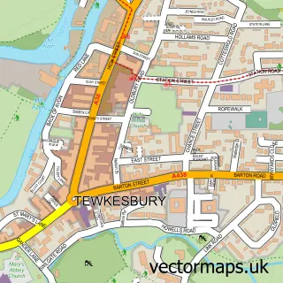

More street maps in Gloucestershire
750 metre map area coverage
Boundary, postcode and point of interest information for the 750m x 750m rectangle centred on this sample map.
Boundaries containing map centre
Constituency: Tewkesbury Co Const
County: Gloucestershire County
District: Tewkesbury District (B)
Icb: NHS Gloucestershire ICB
Parish: Norton CP
Police Force: gloucestershire
Postcode District: GL2
Postcode Sector: GL2 9
Ward: Severn Vale South Ward
Nearby boundaries intersecting sample
Parish: Down Hatherley CP
Postcode coverage
POI category counts
Amateur Sports Team: 1
Beauty Salon: 1
Beverage Store: 1
Elementary School: 1
Event Planning: 1
Freight And Cargo Service: 1
Furniture Store: 1
Landmark And Historical Building: 1
Naturopathic Holistic: 1
Nutritionist: 1
Sample points of interest
- Norton RFC
- CM Aesthetics
- Kings Head Inn
- Norton C of E Primary School
- Norton Village Hall
- MLC Transport
- Tobias George
- Wainlodes Hill
- Rachel Harvey Therapies
- Chloe Scott
- New Dawn Inn
- Gloucester Clay Shooting Club
Create a larger editable map of Norton
This sample shows only a 750 metre area. To create a larger map of Norton, use our map builder to choose your own coverage area, add titles and download editable SVG, PDF and PNG files.
Create a custom map of Norton