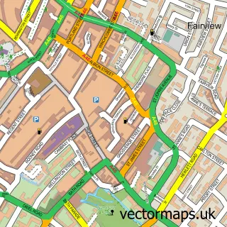
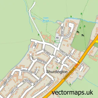
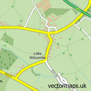
This Churchdown street map is a detailed vector street map covering a 750m x 750m area. Select a larger area to create and download your own vector street map of Churchdown.
The 750-metre map sample for Churchdown covers 471 mapped buildings and approximately 45.3 km of road detail, of which 35 named roads are named. The immediate area includes 2 schools, 3 GP surgeries within 2 miles, 2 pubs and 7 MOT stations within 2 miles. The wider area around Churchdown features 4 food and drink venues and 1 campsite within 2 miles. To create a larger or custom map of Churchdown, the map builder lets you define your own coverage area and download editable SVG, PDF and PNG files.
Create a larger editable map of Churchdown
Choose any area you need and generate a high-quality vector map instantly. Perfect for print, planning, design, business and personal use.

This Churchdown street map in Gloucestershire is available as downloadable SVG, PDF and PNG map files, or as a printed map for planning, business, display, education, local information and design work. You can also create a larger custom map area using the map selector.
What this Churchdown map sample shows
Churchdown lies within Churchdown Cp parish, part of Churchdown Brookfield With Hucclecote ward in the Tewkesbury District (B) local authority area. The postcode geography for this area includes the GL postcode area, the GL3 postcode district and the GL3 2 postcode sector. Residents fall under the Nhs Gloucestershire Integrated Care Board for NHS services.
Local features near Churchdown
Within 2 milesAmenities and services in and around Churchdown.
Administrative and postcode information for Churchdown
Churchdown lies within Churchdown Cp parish, part of Churchdown Brookfield With Hucclecote ward in the Tewkesbury District (B) local authority area. The postcode geography for this area includes the GL postcode area, the GL3 postcode district and the GL3 2 postcode sector. Residents fall under the Nhs Gloucestershire Integrated Care Board for NHS services.
Nearby street map samples around Churchdown

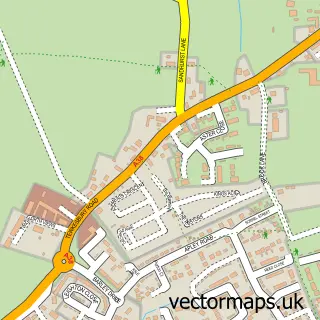
More street maps in Gloucestershire
750 metre map area coverage
Boundary, postcode and point of interest information for the 750m x 750m rectangle centred on this sample map.
Boundaries containing map centre
Constituency: North Cotswolds Co Const
County: Gloucestershire County
District: Tewkesbury District (B)
Icb: NHS Gloucestershire ICB
Parish: Churchdown CP
Police Force: gloucestershire
Postcode District: GL3
Postcode Sector: GL3 2
Ward: Churchdown Brookfield with Hucclecote Ward
Nearby boundaries intersecting sample
No additional intersecting boundaries found.
Postcode coverage
POI category counts
Church Cathedral: 3
Real Estate Agent: 3
Auto Upholstery: 2
Building Supply Store: 2
Contractor: 2
Elementary School: 2
Hair Salon: 2
Professional Services: 2
Pub: 2
Scout Hall: 2
Sample points of interest
- The Manor
- St. Andrew's Church - Churchdown
- Delightful Vintage Decor ชุดถ้วยชากาแฟ และของแต่งบ้านวินเทจ จากยุโรป
- Midland Heart Retirement Home
- Chosen Curtains
- Ian's Upholstery
- The Village Cakery
- The Glow Studio
- Lisa Walby Hair
- Codel Consulting Ltd
- PJA Carpentry Services
- Jas Inovative
Create a larger editable map of Churchdown
This sample shows only a 750 metre area. To create a larger map of Churchdown, use our map builder to choose your own coverage area, add titles and download editable SVG, PDF and PNG files.
Create a custom map of Churchdown