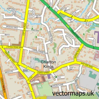
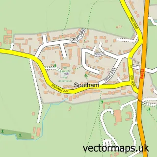
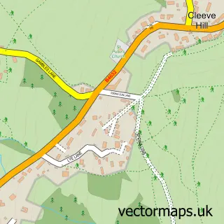
This Cheltenham street map is a detailed vector street map covering a 750m x 750m area. Select a larger area to create and download your own vector street map of Cheltenham.
The 750-metre map sample for Cheltenham covers 275 mapped buildings and approximately 88.2 km of road detail, of which 83 named roads are named. The immediate area includes 2 schools, 12 GP surgeries within 2 miles, 30 pubs and 3 MOT stations, with 38 within 2 miles. The wider area around Cheltenham features 12 tourism points of interest, 84 food and drink venues and 6 hotels. To create a larger or custom map of Cheltenham, the map builder lets you define your own coverage area and download editable SVG, PDF and PNG files.
Create a larger editable map of Cheltenham
Choose any area you need and generate a high-quality vector map instantly. Perfect for print, planning, design, business and personal use.

This Cheltenham street map in Gloucestershire is available as downloadable SVG, PDF and PNG map files, or as a printed map for planning, business, display, education, local information and design work. You can also create a larger custom map area using the map selector.
What this Cheltenham map sample shows
Cheltenham lies within Gloucestershire County parish, part of College ward in the Cheltenham District (B) local authority area. The postcode geography for this area includes the GL postcode area, the GL50 postcode district and the GL50 1 postcode sector. Residents fall under the Nhs Gloucestershire Integrated Care Board for NHS services.
Local features near Cheltenham
Within 2 milesAmenities and services in and around Cheltenham.
Administrative and postcode information for Cheltenham
The local authority covering Cheltenham is Cheltenham District (B), within the county of Gloucestershire. The settlement lies within College ward and Gloucestershire County civil parish. The GL50 postcode district and GL50 1 postcode sector serve the immediate area. NHS provision in the area is delivered through Gloucestershire Hospitals Nhs Foundation Trust.
Nearby street map samples around Cheltenham

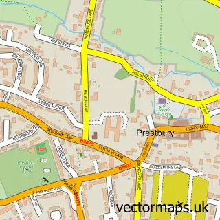
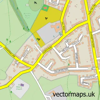
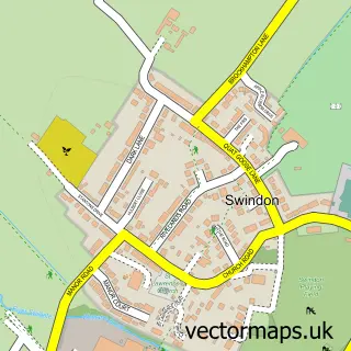
More street maps in Gloucestershire
750 metre map area coverage
Boundary, postcode and point of interest information for the 750m x 750m rectangle centred on this sample map.
Boundaries containing map centre
Constituency: Cheltenham Boro Const
County: Gloucestershire County
District: Cheltenham District (B)
Icb: NHS Gloucestershire ICB
Police Force: gloucestershire
Postcode District: GL52
Postcode Sector: GL52 2
Ward: All Saints Ward
Nearby boundaries intersecting sample
Postcode District: GL50, GL53
Postcode Sector: GL50 1, GL50 3, GL50 4, GL52 6, GL53 7
Ward: Charlton Park Ward, College Ward, Lansdown Ward, Pittville Ward, St. Paul's Ward
Postcode coverage
POI category counts
Clothing Store: 51
Pub: 30
Hair Salon: 27
Beauty Salon: 26
Professional Services: 26
Barber: 21
Jewelry Store: 21
Shoe Store: 21
Coffee Shop: 20
Cafe: 19
Sample points of interest
- GenR8 Regency
- Hewlett Apartments
- Cirrus Cloud Accounting
- Easy Accountancy
- Louise Newman & Co
- My Accounts Office
- Paish Tooth
- Profits Plus
- SkyBridge Accounting
- Trio Accountancy Services
- Eat Sleep Axe
- Anna Darrock
Create a larger editable map of Cheltenham
This sample shows only a 750 metre area. To create a larger map of Cheltenham, use our map builder to choose your own coverage area, add titles and download editable SVG, PDF and PNG files.
Create a custom map of Cheltenham