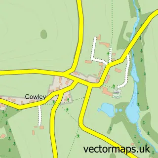
This Leckhampton street map is a detailed vector street map covering a 750m x 750m area. Select a larger area to create and download your own vector street map of Leckhampton.
The 750-metre map sample for Leckhampton covers 302 mapped buildings and approximately 30.6 km of road detail, of which 21 named roads are named. The immediate area includes 1 school, 5 GP surgeries within 2 miles and 18 MOT stations within 2 miles. The wider area around Leckhampton features 1 tourism point of interest and 1 food and drink venue. To create a larger or custom map of Leckhampton, the map builder lets you define your own coverage area and download editable SVG, PDF and PNG files.
Create a larger editable map of Leckhampton
Choose any area you need and generate a high-quality vector map instantly. Perfect for print, planning, design, business and personal use.

This Leckhampton street map in Gloucestershire is available as downloadable SVG, PDF and PNG map files, or as a printed map for planning, business, display, education, local information and design work. You can also create a larger custom map area using the map selector.
What this Leckhampton map sample shows
Leckhampton lies within Leckhampton With Warden Hill Cp parish, part of Leckhampton ward in the Cheltenham District (B) local authority area. The postcode geography for this area includes the GL postcode area, the GL53 postcode district and the GL53 0 postcode sector. Residents fall under the Nhs Gloucestershire Integrated Care Board for NHS services.
Local features near Leckhampton
Within 2 milesAmenities and services in and around Leckhampton.
Administrative and postcode information for Leckhampton
Leckhampton lies within Leckhampton With Warden Hill Cp parish, part of Leckhampton ward in the Cheltenham District (B) local authority area. The postcode geography for this area includes the GL postcode area, the GL53 postcode district and the GL53 0 postcode sector. Residents fall under the Nhs Gloucestershire Integrated Care Board for NHS services.
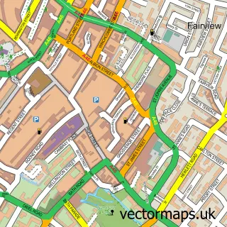
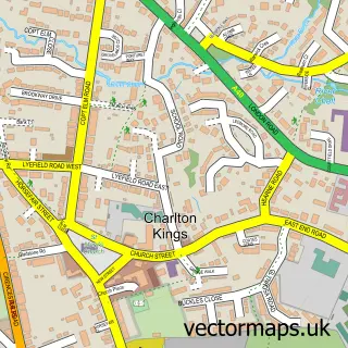
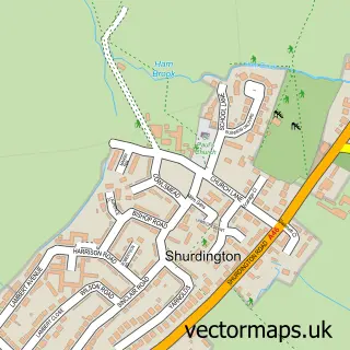
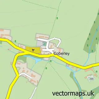
Nearby street map samples around Leckhampton

More street maps in Gloucestershire
750 metre map area coverage
Boundary, postcode and point of interest information for the 750m x 750m rectangle centred on this sample map.
Boundaries containing map centre
Constituency: Cheltenham Boro Const
County: Gloucestershire County
District: Cheltenham District (B)
Icb: NHS Gloucestershire ICB
Parish: Leckhampton with Warden Hill CP
Police Force: gloucestershire
Postcode District: GL53
Postcode Sector: GL53 0
Ward: Leckhampton Ward
Nearby boundaries intersecting sample
Constituency: North Cotswolds Co Const
District: Tewkesbury District (B)
Parish: Shurdington CP
Postcode Sector: GL53 9
Ward: Shurdington Ward
Postcode coverage
POI category counts
Elementary School: 2
Anglican Church: 1
Assisted Living Facility: 1
Automotive Repair: 1
Bakery: 1
Campground: 1
Caterer: 1
Coffee Shop: 1
Community Center: 1
Convenience Store: 1
Sample points of interest
- St Peter's Church
- Sue Ryder Leckhampton Court Hospice
- Smart Fit
- Hannah Hickman Creative Cake Makers
- Leckhampton Scout Hut
- Mini Morsels
- Costa Express
- Leckhampton Village Hall
- Leckhampton Convenience Store
- Leckhampton Tappers
- Porch House Clinic
- Gloucestershire County Council
Create a larger editable map of Leckhampton
This sample shows only a 750 metre area. To create a larger map of Leckhampton, use our map builder to choose your own coverage area, add titles and download editable SVG, PDF and PNG files.
Create a custom map of Leckhampton