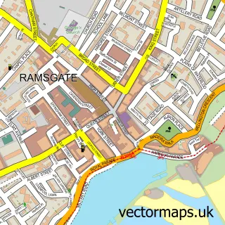
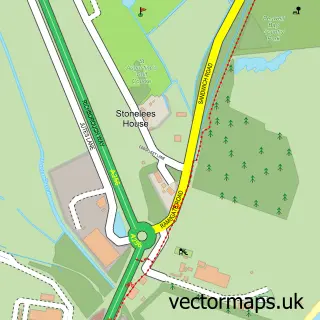
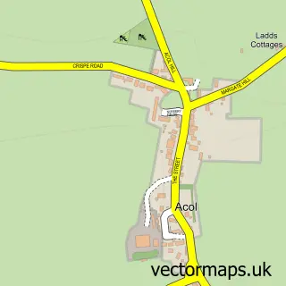
This Pegwell street map is a detailed vector street map covering a 750m x 750m area. Select a larger area to create and download your own vector street map of Pegwell.
The 750-metre map sample for Pegwell covers 207 mapped buildings and approximately 9.8 km of road detail, of which 18 named roads are named. The immediate area includes 4 GP surgeries within 2 miles, 2 pubs and 11 MOT stations within 2 miles. The wider area around Pegwell features 5 tourism points of interest, 3 food and drink venues and 2 hotels. To create a larger or custom map of Pegwell, the map builder lets you define your own coverage area and download editable SVG, PDF and PNG files.
Create a larger editable map of Pegwell
Choose any area you need and generate a high-quality vector map instantly. Perfect for print, planning, design, business and personal use.

This Pegwell street map in Kent is available as downloadable SVG, PDF and PNG map files, or as a printed map for planning, business, display, education, local information and design work. You can also create a larger custom map area using the map selector.
What this Pegwell map sample shows
Pegwell lies within Cliffsend Cp parish, part of Cliffsend And Pegwell ward in the Thanet District local authority area. The postcode geography for this area includes the CT postcode area, the CT12 postcode district and the CT12 5 postcode sector. Residents fall under the Nhs Kent And Medway Integrated Care Board for NHS services.
Local features near Pegwell
Within 2 milesAmenities and services in and around Pegwell.
Administrative and postcode information for Pegwell
Pegwell lies within Cliffsend Cp parish, part of Cliffsend And Pegwell ward in the Thanet District local authority area. The postcode geography for this area includes the CT postcode area, the CT12 postcode district and the CT12 5 postcode sector. Residents fall under the Nhs Kent And Medway Integrated Care Board for NHS services.
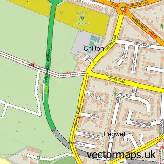
Nearby street map samples around Pegwell

More street maps in Kent
750 metre map area coverage
Boundary, postcode and point of interest information for the 750m x 750m rectangle centred on this sample map.
Boundaries containing map centre
Constituency: East Thanet Boro Const
County: Kent County
District: Thanet District
Icb: NHS Kent and Medway ICB
Parish: Ramsgate CP
Police Force: kent
Postcode District: CT11
Postcode Sector: CT11 0
Ward: Cliffsend and Pegwell Ward
Nearby boundaries intersecting sample
No additional intersecting boundaries found.
Postcode coverage
POI category counts
Park: 4
Beach: 2
Hotel: 2
Pub: 2
Attractions And Activities: 1
Beer Garden: 1
Building Supply Store: 1
Childrens Clothing Store: 1
Cleaning Services: 1
Contractor: 1
Sample points of interest
- Western Chine
- Pegwell Bay
- Ramsgate Seafront
- The Bellvue Tavern
- Isle Quality Painting
- Always Casting Memories
- Acorn Cleaning Contractors
- South East Ties LTD
- Zane's Magic Shop
- The Pegwell Bay Hotel
- The Seaview Restaurant At The Sir Stanley Gray
- Cjf Plumbing
Create a larger editable map of Pegwell
This sample shows only a 750 metre area. To create a larger map of Pegwell, use our map builder to choose your own coverage area, add titles and download editable SVG, PDF and PNG files.
Create a custom map of Pegwell