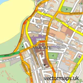
This Westwood street map is a detailed vector street map covering a 750m x 750m area. Select a larger area to create and download your own vector street map of Westwood.
The 750-metre map sample for Westwood covers 194 mapped buildings and approximately 17.4 km of road detail, of which 21 named roads are named. The immediate area includes 6 GP surgeries within 2 miles, 4 pubs and 1 MOT station, with 31 within 2 miles. The wider area around Westwood features 1 tourism point of interest, 22 food and drink venues and 1 hotel. To create a larger or custom map of Westwood, the map builder lets you define your own coverage area and download editable SVG, PDF and PNG files.
Create a larger editable map of Westwood
Choose any area you need and generate a high-quality vector map instantly. Perfect for print, planning, design, business and personal use.

This Westwood street map in Kent is available as downloadable SVG, PDF and PNG map files, or as a printed map for planning, business, display, education, local information and design work. You can also create a larger custom map area using the map selector.
What this Westwood map sample shows
Westwood lies within Broadstairs And St. Peters Cp parish, part of St Peters ward in the Thanet District local authority area. The postcode geography for this area includes the CT postcode area, the CT10 postcode district and the CT10 2 postcode sector. Residents fall under the Nhs Kent And Medway Integrated Care Board for NHS services.
Local features near Westwood
Within 2 milesAmenities and services in and around Westwood.
Administrative and postcode information for Westwood
Westwood lies within Broadstairs And St. Peters Cp parish, part of St Peters ward in the Thanet District local authority area. The postcode geography for this area includes the CT postcode area, the CT10 postcode district and the CT10 2 postcode sector. Residents fall under the Nhs Kent And Medway Integrated Care Board for NHS services.
Nearby street map samples around Westwood

More street maps in Kent
750 metre map area coverage
Boundary, postcode and point of interest information for the 750m x 750m rectangle centred on this sample map.
Boundaries containing map centre
Constituency: East Thanet Boro Const
County: Kent County
District: Thanet District
Icb: NHS Kent and Medway ICB
Parish: Broadstairs and St. Peters CP
Police Force: kent
Postcode District: CT10
Postcode Sector: CT10 2
Ward: St. Peters Ward
Nearby boundaries intersecting sample
Constituency: Herne Bay and Sandwich Co Const
Parish: Manston CP, Ramsgate CP
Postcode District: CT12, CT9
Postcode Sector: CT12 5, CT12 6, CT9 4
Ward: Northwood Ward, Salmestone Ward, Thanet Villages Ward
Postcode coverage
POI category counts
Clothing Store: 13
Coffee Shop: 12
Shoe Store: 8
Furniture Store: 6
Supermarket: 6
Carpet Store: 5
Mobile Phone Store: 5
Retail: 5
Cafe: 4
Gym: 4
Sample points of interest
- Jump Inc by AirHop Adventure & Trampoline Park Westwood Cross
- D A Z U
- Hobbycraft
- Barclays ATM
- Halfords Autocentre Thanet
- Euro Car Parts
- Thanet
- InstaVolt
- Mamas & Papas
- Greggs
- The Bakers Oven
- HSBC Bank
Create a larger editable map of Westwood
This sample shows only a 750 metre area. To create a larger map of Westwood, use our map builder to choose your own coverage area, add titles and download editable SVG, PDF and PNG files.
Create a custom map of Westwood