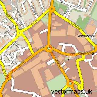
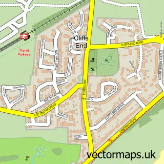
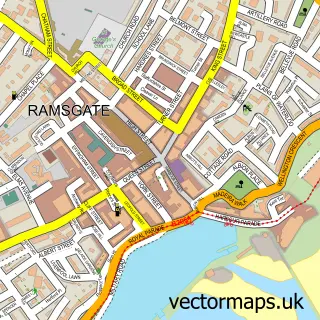
This Broadstairs street map is a detailed vector street map covering a 750m x 750m area. Select a larger area to create and download your own vector street map of Broadstairs.
The 750-metre map sample for Broadstairs covers 418 mapped buildings and approximately 18.9 km of road detail, of which 57 named roads are named. The immediate area includes 6 GP surgeries within 2 miles, 15 pubs and 2 MOT stations, with 17 within 2 miles. The wider area around Broadstairs features 11 tourism points of interest, 47 food and drink venues and 16 hotels. To create a larger or custom map of Broadstairs, the map builder lets you define your own coverage area and download editable SVG, PDF and PNG files.
Create a larger editable map of Broadstairs
Choose any area you need and generate a high-quality vector map instantly. Perfect for print, planning, design, business and personal use.

This Broadstairs street map in Kent is available as downloadable SVG, PDF and PNG map files, or as a printed map for planning, business, display, education, local information and design work. You can also create a larger custom map area using the map selector.
What this Broadstairs map sample shows
Broadstairs lies within Broadstairs And St. Peters Cp parish, part of Viking ward in the Thanet District local authority area. The postcode geography for this area includes the CT postcode area, the CT10 postcode district and the CT10 1 postcode sector. Residents fall under the Nhs Kent And Medway Integrated Care Board for NHS services.
Local features near Broadstairs
Within 2 milesAmenities and services in and around Broadstairs.
Administrative and postcode information for Broadstairs
The local authority covering Broadstairs is Thanet District, within the county of Kent. The settlement lies within Viking ward and Broadstairs And St. Peters Cp civil parish. The CT10 postcode district and CT10 1 postcode sector serve the immediate area. NHS provision in the area is delivered through East Kent Hospitals University Nhs Foundation Trust.
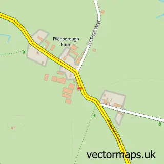
Nearby street map samples around Broadstairs

More street maps in Kent
750 metre map area coverage
Boundary, postcode and point of interest information for the 750m x 750m rectangle centred on this sample map.
Boundaries containing map centre
Constituency: East Thanet Boro Const
County: Kent County
District: Thanet District
Icb: NHS Kent and Medway ICB
Parish: Broadstairs and St. Peters CP
Police Force: kent
Postcode District: CT10
Postcode Sector: CT10 1
Ward: Bradstowe Ward
Nearby boundaries intersecting sample
Ward: Viking Ward
Postcode coverage
POI category counts
Hotel: 16
Pub: 15
Real Estate Agent: 14
Bed And Breakfast: 13
Cafe: 12
Flowers And Gifts Shop: 12
Restaurant: 12
Hair Salon: 11
Holiday Rental Home: 10
Bar: 9
Sample points of interest
- AIMS Accountants for Business
- David J Cox
- Kemps
- Pure Cloud Accounting
- Sincerity Advertising
- Breathing Space Clinic
- Brooklyn Bar & Diner
- Phileas Fogg
- Raindell's
- RSPCA
- Albie and Pearl
- Andrew Acquier
Create a larger editable map of Broadstairs
This sample shows only a 750 metre area. To create a larger map of Broadstairs, use our map builder to choose your own coverage area, add titles and download editable SVG, PDF and PNG files.
Create a custom map of Broadstairs