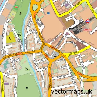
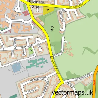
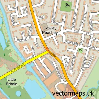
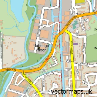
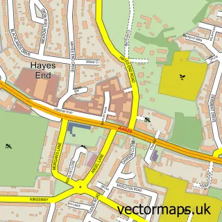
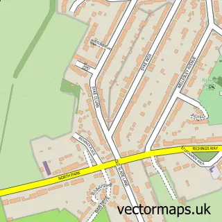
This Pield Heath street map is a detailed vector street map covering a 750m x 750m area. Select a larger area to create and download your own vector street map of Pield Heath.
The 750-metre map sample for Pield Heath covers 202 mapped buildings and approximately 7.8 km of road detail, of which 14 named roads are named. The immediate area includes 2 schools, 14 GP surgeries within 2 miles and 18 MOT stations within 2 miles. The wider area around Pield Heath features 1 tourism point of interest. To create a larger or custom map of Pield Heath, the map builder lets you define your own coverage area and download editable SVG, PDF and PNG files.
Create a larger editable map of Pield Heath
Choose any area you need and generate a high-quality vector map instantly. Perfect for print, planning, design, business and personal use.

This Pield Heath street map in Greater London is available as downloadable SVG, PDF and PNG map files, or as a printed map for planning, business, display, education, local information and design work. You can also create a larger custom map area using the map selector.
What this Pield Heath map sample shows
Pield Heath lies within Greater London Authority parish, part of Uxbridge South ward in the Hillingdon London Boro local authority area. The postcode geography for this area includes the UB postcode area, the UB8 postcode district and the UB8 2 postcode sector. Residents fall under the Nhs North West London Integrated Care Board for NHS services.
Local features near Pield Heath
Within 2 milesAmenities and services in and around Pield Heath.
Administrative and postcode information for Pield Heath
The local authority covering Pield Heath is Hillingdon London Boro, within the county of Greater London. The settlement lies within Uxbridge South ward and Greater London Authority civil parish. The UB8 postcode district and UB8 2 postcode sector serve the immediate area. NHS provision in the area is delivered through The Hillingdon Hospitals Nhs Foundation Trust.
Nearby street map samples around Pield Heath

More street maps in Greater London
750 metre map area coverage
Boundary, postcode and point of interest information for the 750m x 750m rectangle centred on this sample map.
Boundaries containing map centre
Constituency: Uxbridge and South Ruislip Boro Const
County: Greater London Authority
District: Hillingdon London Boro
Icb: NHS West and North London IC
Police Force: metropolitan
Postcode District: UB8
Postcode Sector: UB8 3
Ward: Colham & Cowley Ward
Nearby boundaries intersecting sample
No additional intersecting boundaries found.
Postcode coverage
POI category counts
College University: 3
Amateur Sports Team: 2
Hospital: 2
Painting: 2
Professional Services: 2
Scout Hall: 2
Specialty School: 2
Ambulance And Ems Services: 1
Archery Range: 1
Builders: 1
Sample points of interest
- Hillingdon Archery Club
- Hillingdon Archery Club
- Hillingdon Ambulance Station
- Hillingdon Archery Club
- MKM Design & Construction
- Marum Healthcare
- St John the Baptist C of E Church
- Brunel - Electronic & Electrical Engineering - EEE
- Brunel University Sports Park
- Engage Brunel
- Removal Company Uxbridge
- Dr Gryglicki & Crow
Create a larger editable map of Pield Heath
This sample shows only a 750 metre area. To create a larger map of Pield Heath, use our map builder to choose your own coverage area, add titles and download editable SVG, PDF and PNG files.
Create a custom map of Pield Heath