Vector Maps logo
Home Why it works Popular maps Districts Samples Customizer Create Your Map
VectorMaps.uk
Home Popular maps Districts Samples Customizer Create Your Map Privacy Disclaimer
Home / UK Maps / Ross and Cromarty / Portree Map

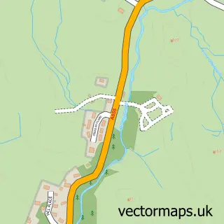
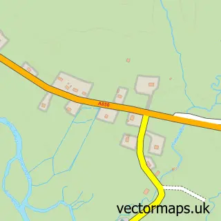
This Portree street map is a detailed vector street map covering a 750m x 750m area. Select a larger area to create and download your own vector street map of Portree.

Portree is a town in Ross And Cromarty, in the Highlands And Islands of Scotland. Historically, the area formed part of Inverness-Shire. The settlement falls within the Ross, Skye And Lochaber parliamentary constituency. It is served by the IV51 postcode

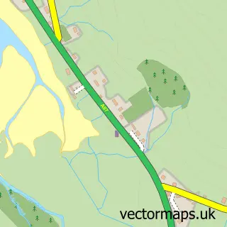
The 750-metre map sample for Portree covers 119 mapped buildings and approximately 15.6 km of road detail, of which 39 named roads are named. The immediate area includes 1 GP surgery, 1 pub and 1 MOT station within 2 miles. The wider area around Portree features 14 tourism points of interest, 14 food and drink venues and 23 hotels. To create a larger or custom map of Portree, the map builder lets you define your own coverage area and download editable SVG, PDF and PNG files.

119Buildings
15.62 kmRoads
39Named roads
0Residents within 2 miles
Create your own

Create a larger editable map of Portree

Choose any area you need and generate a high-quality vector map instantly. Perfect for print, planning, design, business and personal use.

Choose any location
Editable SVG files
Any size up to A0
PDF, PNG & more
Instant download
High quality guaranteed
Create My Custom Map
Secure, private & no credit card required
Portree Vector Street Map
750m Sample
Portree vector street map sample showing roads, buildings and local features in a 750 metre preview area
Buy Portree Map Print from £12.95 Buy Portree Digital Map from £6

This Portree street map in Ross and Cromarty is available as downloadable SVG, PDF and PNG map files, or as a printed map for planning, business, display, education, local information and design work. You can also create a larger custom map area using the map selector.

What this Portree map sample shows

Portree lies within Highland parish, part of Eilean A Cheo ward in the Highland local authority area. The postcode geography for this area includes the IV postcode area, the IV51 postcode district and the IV51 9 postcode sector. Residents fall under the Highland for NHS services.

Local features near Portree

Within 2 miles

Amenities and services in and around Portree.

1 Campsites within 2 miles
1 GP surgeries 1 within 2 miles
1 MOT stations within 2 miles
14 Tourism & leisure
14 Food & drink
1 Pubs
23 Hotels
5 Healthcare POIs

Counts are approximate and based on publicly available data.

Administrative and postcode information for Portree

The local authority covering Portree is Highland, within the county of Ross And Cromarty. The settlement lies within Eilean A Cheo ward and Highland civil parish. The IV51 postcode district and IV51 9 postcode sector serve the immediate area. NHS provision in the area is delivered through Highland.

Parish HIGHLAND
Ward Eilean a Cheo
District / local authority Highland
County Ross and Cromarty
Historic county Inverness-shire
Postcode district IV51
Postcode sector IV51 9
Parliamentary constituency Ross, Skye and Lochaber
Region Highlands and Islands
Country Scotland

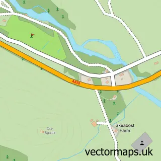
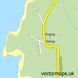
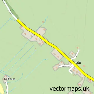
Nearby street map samples around Portree

Street map sample of Inverness, Inverness Inverness City - Inverness - 73.3 miles Street map sample of Port Failthe, Ross and Cromarty Port Failthe Village - Ross and Cromarty - 0.9 miles Street map sample of Achadh a' Choirce, Ross and Cromarty Achadh a' Choirce Village - Ross and Cromarty - 1.3 miles Street map sample of Camustianavaig, Ross and Cromarty Camustianavaig Village - Ross and Cromarty - 3.2 miles Street map sample of Borbh, Ross and Cromarty Borbh Village - Ross and Cromarty - 3.7 miles Street map sample of Carbost, Ross and Cromarty Carbost Village - Ross and Cromarty - 4.3 miles Street map sample of Skeabost, Ross and Cromarty Skeabost Village - Ross and Cromarty - 5.0 miles Street map sample of Oskaig, Ross and Cromarty Oskaig Village - Ross and Cromarty - 5.3 miles Street map sample of Tobhta, Ross and Cromarty Tobhta Village - Ross and Cromarty - 5.3 miles Street map sample of Kensaleyre, Ross and Cromarty Kensaleyre Village - Ross and Cromarty - 6.3 miles

More street maps in Ross and Cromarty

Street map sample of Port Failthe, Ross and Cromarty Port Failthe Village - 0.9 miles Street map sample of Achadh a' Choirce, Ross and Cromarty Achadh a' Choirce Village - 1.3 miles Street map sample of Camustianavaig, Ross and Cromarty Camustianavaig Village - 3.2 miles Street map sample of Borbh, Ross and Cromarty Borbh Village - 3.7 miles Street map sample of Carbost, Ross and Cromarty Carbost Village - 4.3 miles

750 metre map area coverage

Boundary, postcode and point of interest information for the 750m x 750m rectangle centred on this sample map.

Boundaries containing map centre

Constituency: Inverness, Skye and West Ross-shire Co Const

District: Highland

Icb: Highland

Postcode District: IV51

Postcode Sector: IV51 9

Ward: Eilean a' Cheo Ward

Nearby boundaries intersecting sample

No additional intersecting boundaries found.

Postcode coverage

IV51 IV51 9

POI category counts

Hotel: 23

Bed And Breakfast: 18

Landmark And Historical Building: 12

Flowers And Gifts Shop: 8

Cafe: 7

Holiday Rental Home: 7

Hostel: 4

Real Estate: 4

Restaurant: 4

Seafood Restaurant: 4

Sample points of interest

  • Highfield Sky Accommodation
  • Donald Rankin Business Services Accountant
  • The Cuillins, Skye Active Life
  • Biome volleyball 68 Advertising Agency
  • Pelican Design Consultants Advertising Agency
  • Scottish Hydro Electric Appliance Store
  • Isle of Skye Highland Games Art Gallery
  • Skye Batiks Arts And Crafts
  • Mackenzies Bakery Bakery
  • The Bakeaway Bakery
  • Bank of Scotland Bank Credit Union
  • RBS Portree Bank Credit Union

Create a larger editable map of Portree

This sample shows only a 750 metre area. To create a larger map of Portree, use our map builder to choose your own coverage area, add titles and download editable SVG, PDF and PNG files.

Create a custom map of Portree

Phone 01751 473136 | Copyright Vectormaps.uk 2026

Samples Customizer Privacy Disclaimer
Portree Vector Street Map
Portree enlarged street map sample showing a 750 metre preview area