This Presteigne street map is a detailed vector street map covering a 750m x 750m area. Select a larger area to create and download your own vector street map of Presteigne.
The 750-metre map sample for Presteigne covers 379 mapped buildings and approximately 48.9 km of road detail, of which 29 named roads are named. The immediate area includes 1 school, 4 pubs and 2 MOT stations. The wider area around Presteigne features 2 tourism points of interest, 12 food and drink venues and 3 hotels. To create a larger or custom map of Presteigne, the map builder lets you define your own coverage area and download editable SVG, PDF and PNG files.
Create a larger editable map of Presteigne
Choose any area you need and generate a high-quality vector map instantly. Perfect for print, planning, design, business and personal use.

This Presteigne street map in Powys is available as downloadable SVG, PDF and PNG map files, or as a printed map for planning, business, display, education, local information and design work. You can also create a larger custom map area using the map selector.
What this Presteigne map sample shows
Presteigne lies within Presteigne Community parish, part of Presteigne ward in the Powys - Powys local authority area. The postcode geography for this area includes the LD postcode area, the LD8 postcode district and the LD8 2 postcode sector. Residents fall under the Powys Teaching Health Board for NHS services.
Local features near Presteigne
Within 2 milesAmenities and services in and around Presteigne.
Administrative and postcode information for Presteigne
The local authority covering Presteigne is Powys - Powys, within the county of Powys. The settlement lies within Presteigne ward and Presteigne Community civil parish. The LD8 postcode district and LD8 2 postcode sector serve the immediate area. NHS provision in the area is delivered through Powys Teaching Health Board.
Nearby street map samples around Presteigne

More street maps in Powys
750 metre map area coverage
Boundary, postcode and point of interest information for the 750m x 750m rectangle centred on this sample map.
Boundaries containing map centre
Constituency: Brecon, Radnor and Cwm Tawe Co Const
District: Powys - Powys
Icb: Powys Teaching
Parish: Presteigne Community
Police Force: dyfed-powys
Postcode District: LD8
Postcode Sector: LD8 2
Nearby boundaries intersecting sample
Constituency: North Herefordshire Co Const
District: County of Herefordshire
Icb: NHS Herefordshire and Worcestershire ICB
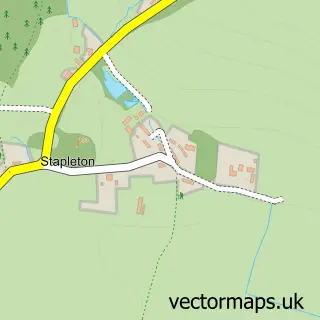
Parish: Stapleton CP
Police Force: west mercia
Ward: Mortimer Ward
Postcode coverage
POI category counts
Building Supply Store: 5
Cafe: 4
Pub: 4
Flowers And Gifts Shop: 3
Hotel: 3
Restaurant: 3
Antique Store: 2
Arts And Entertainment: 2
Assisted Living Facility: 2
Automotive Repair: 2
Sample points of interest
- Elsa Jones Accountants
- Vanessa Hamilton, Lic.Ac M.B.Ac.C
- Brixton Pottery
- Field Options Ltd
- St Andrew's Presteigne
- Cole's Curiosities
- Courtyard Antiques,Presteigne, Wales.
- Brixton Pottery
- Assembly Rooms
- Presteigne Festival
- Bupa Care Homes Group Limited
- Prestemede
Create a larger editable map of Presteigne
This sample shows only a 750 metre area. To create a larger map of Presteigne, use our map builder to choose your own coverage area, add titles and download editable SVG, PDF and PNG files.
Create a custom map of Presteigne