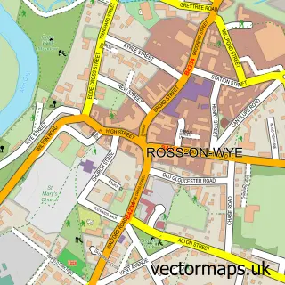
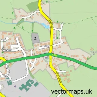
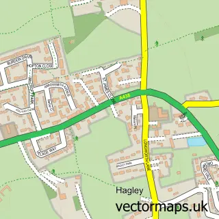
This Hereford street map is a detailed vector street map covering a 750m x 750m area. Select a larger area to create and download your own vector street map of Hereford.
The 750-metre map sample for Hereford covers 204 mapped buildings and approximately 60.8 km of road detail, of which 57 named roads are named. The immediate area includes 1 school, 2 GP surgeries, with 4 within 2 miles, 25 pubs and 3 MOT stations, with 32 within 2 miles. The wider area around Hereford features 12 tourism points of interest, 85 food and drink venues and 10 hotels. To create a larger or custom map of Hereford, the map builder lets you define your own coverage area and download editable SVG, PDF and PNG files.
Create a larger editable map of Hereford
Choose any area you need and generate a high-quality vector map instantly. Perfect for print, planning, design, business and personal use.

This Hereford street map in Herefordshire is available as downloadable SVG, PDF and PNG map files, or as a printed map for planning, business, display, education, local information and design work. You can also create a larger custom map area using the map selector.
What this Hereford map sample shows
Hereford lies within Hereford Cp parish, part of Aylestone Hill ward in the County Of Herefordshire local authority area. The postcode geography for this area includes the HR postcode area, the HR1 postcode district and the HR1 1 postcode sector. Residents fall under the Nhs Herefordshire And Worcestershire Integrated Care Board for NHS services.
Local features near Hereford
Within 2 milesAmenities and services in and around Hereford.
Administrative and postcode information for Hereford
The local authority covering Hereford is County Of Herefordshire, within the county of Herefordshire. The settlement lies within Aylestone Hill ward and Hereford Cp civil parish. The HR1 postcode district and HR1 1 postcode sector serve the immediate area. NHS provision in the area is delivered through Wye Valley Nhs Trust.
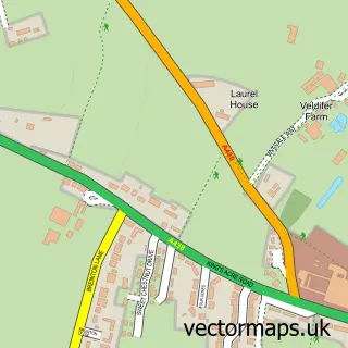
Nearby street map samples around Hereford
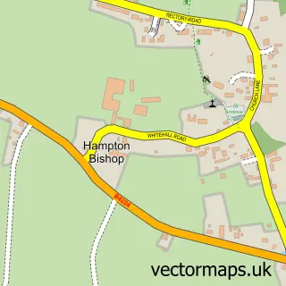
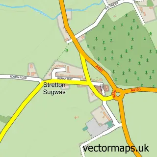
More street maps in Herefordshire
750 metre map area coverage
Boundary, postcode and point of interest information for the 750m x 750m rectangle centred on this sample map.
Boundaries containing map centre
Constituency: Hereford and South Herefordshire Co Const
District: County of Herefordshire
Icb: NHS Herefordshire and Worcestershire ICB
Parish: Hereford CP
Police Force: west mercia
Postcode District: HR1
Postcode Sector: HR1 2
Ward: Central Ward
Nearby boundaries intersecting sample
Postcode District: HR2, HR4
Postcode Sector: HR2 7, HR4 0, HR4 9
Ward: Greyfriars Ward, Hinton & Hunderton Ward, Widemarsh Ward
Postcode coverage
POI category counts
Clothing Store: 32
Beauty Salon: 31
Hair Salon: 28
Pub: 25
Cafe: 24
Professional Services: 24
Real Estate Agent: 24
Charity Organization: 23
Restaurant: 21
Jewelry Store: 18
Sample points of interest
- Haines Watts
- Haines Watts Hereford
- Hawkins Priday
- Hobbs Tax Advisor Accountant
- Kinder Digital Accountants
- Kinder Digital Accountants
- Thompson & Co.
- Andrew Brewer Acupuncture BA - Hons Lic, Ac
- China Medicine
- Hereford Acupuncture & Herbs
- R88 Media
- R88Media
Create a larger editable map of Hereford
This sample shows only a 750 metre area. To create a larger map of Hereford, use our map builder to choose your own coverage area, add titles and download editable SVG, PDF and PNG files.
Create a custom map of Hereford