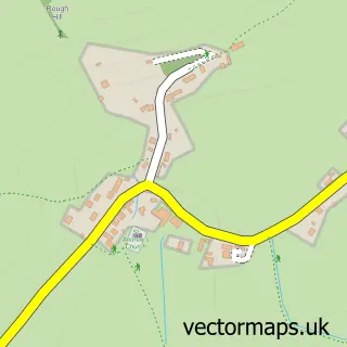
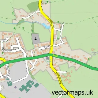
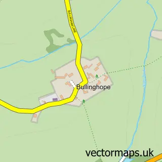
This Hampton Bishop street map is a detailed vector street map covering a 750m x 750m area. Select a larger area to create and download your own vector street map of Hampton Bishop.
The 750-metre map sample for Hampton Bishop covers 107 mapped buildings and approximately 21.0 km of road detail, of which 4 named roads are named. The immediate area includes 5 MOT stations within 2 miles. The wider area around Hampton Bishop features 1 campsite within 2 miles. To create a larger or custom map of Hampton Bishop, the map builder lets you define your own coverage area and download editable SVG, PDF and PNG files.
Create a larger editable map of Hampton Bishop
Choose any area you need and generate a high-quality vector map instantly. Perfect for print, planning, design, business and personal use.

This Hampton Bishop street map in Herefordshire is available as downloadable SVG, PDF and PNG map files, or as a printed map for planning, business, display, education, local information and design work. You can also create a larger custom map area using the map selector.
What this Hampton Bishop map sample shows
Hampton Bishop lies within Hampton Bishop Cp parish, part of Backbury ward in the County Of Herefordshire local authority area. The postcode geography for this area includes the HR postcode area, the HR1 postcode district and the HR1 4 postcode sector. Residents fall under the Nhs Herefordshire And Worcestershire Integrated Care Board for NHS services.
Local features near Hampton Bishop
Within 2 milesAmenities and services in and around Hampton Bishop.
Administrative and postcode information for Hampton Bishop
Hampton Bishop lies within Hampton Bishop Cp parish, part of Backbury ward in the County Of Herefordshire local authority area. The postcode geography for this area includes the HR postcode area, the HR1 postcode district and the HR1 4 postcode sector. Residents fall under the Nhs Herefordshire And Worcestershire Integrated Care Board for NHS services.
Nearby street map samples around Hampton Bishop

More street maps in Herefordshire
750 metre map area coverage
Boundary, postcode and point of interest information for the 750m x 750m rectangle centred on this sample map.
Boundaries containing map centre
Constituency: North Herefordshire Co Const
District: County of Herefordshire
Icb: NHS Herefordshire and Worcestershire ICB
Parish: Hampton Bishop CP
Police Force: west mercia
Postcode District: HR1
Postcode Sector: HR1 4
Ward: Backbury Ward
Nearby boundaries intersecting sample
No additional intersecting boundaries found.
Postcode coverage
POI category counts
It Service And Computer Repair: 2
Anglican Church: 1
Art Gallery: 1
Building Supply Store: 1
Driving School: 1
Event Planning: 1
Furniture Store: 1
Home Improvement Store: 1
Industrial Equipment: 1
Massage Therapy: 1
Sample points of interest
- Hampton Bishop: St Andrew
- Wobage Makers Gallery
- White Hall Fabrics
- Clive Gardner
- Redbank Events & Venue Hire
- Repro Furniture Company
- White Hall Flagstones
- Hereford Coffee Services
- Optimisedcomputing
- optimised computing
- Sarah Askey Massage
- Sapphire Medical Aesthetics
Create a larger editable map of Hampton Bishop
This sample shows only a 750 metre area. To create a larger map of Hampton Bishop, use our map builder to choose your own coverage area, add titles and download editable SVG, PDF and PNG files.
Create a custom map of Hampton Bishop