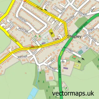
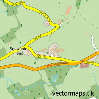
This Shepley Lane Head street map is a detailed vector street map covering a 750m x 750m area. Select a larger area to create and download your own vector street map of Shepley Lane Head.
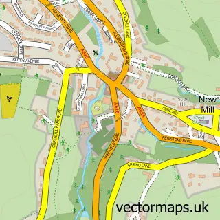
The 750-metre map sample for Shepley Lane Head covers 99 mapped buildings and approximately 16.1 km of road detail, of which 11 named roads are named. The immediate area includes 1 GP surgery within 2 miles, 1 pub and 1 MOT station, with 5 within 2 miles. The wider area around Shepley Lane Head features 4 food and drink venues. To create a larger or custom map of Shepley Lane Head, the map builder lets you define your own coverage area and download editable SVG, PDF and PNG files.
Create a larger editable map of Shepley Lane Head
Choose any area you need and generate a high-quality vector map instantly. Perfect for print, planning, design, business and personal use.

This Shepley Lane Head street map in West Yorkshire is available as downloadable SVG, PDF and PNG map files, or as a printed map for planning, business, display, education, local information and design work. You can also create a larger custom map area using the map selector.
What this Shepley Lane Head map sample shows
Shepley Lane Head lies within Kirkburton Cp parish, part of Kirkburton ward in the Kirklees District (B) local authority area. The postcode geography for this area includes the HD postcode area, the HD8 postcode district and the HD8 8 postcode sector. Residents fall under the Nhs West Yorkshire Integrated Care Board for NHS services.
Local features near Shepley Lane Head
Within 2 milesAmenities and services in and around Shepley Lane Head.
Administrative and postcode information for Shepley Lane Head
The local authority covering Shepley Lane Head is Kirklees District (B), within the county of West Yorkshire. The settlement lies within Kirkburton ward and Kirkburton Cp civil parish. The HD8 postcode district and HD8 8 postcode sector serve the immediate area. NHS provision in the area is delivered through Calderdale And Huddersfield Nhs Foundation Trust.
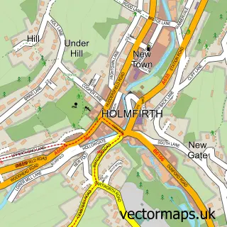
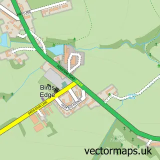
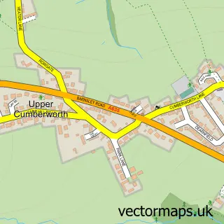
Nearby street map samples around Shepley Lane Head

More street maps in West Yorkshire
750 metre map area coverage
Boundary, postcode and point of interest information for the 750m x 750m rectangle centred on this sample map.
Boundaries containing map centre
Constituency: Ossett and Denby Dale Co Const
District: Kirklees District (B)
Icb: NHS West Yorkshire ICB
Parish: Kirkburton CP
Police Force: west yorkshire
Postcode District: HD8
Postcode Sector: HD8 8
Ward: Kirkburton Ward
Nearby boundaries intersecting sample
Parish: Denby Dale CP
Ward: Denby Dale Ward
Postcode coverage
POI category counts
Gas Station: 6
Coffee Shop: 3
Gym: 2
Auto Glass Service: 1
Automotive Repair: 1
Beauty And Spa: 1
Carpet Store: 1
Dry Cleaning: 1
Energy Management And Conservation Consultants: 1
Grocery Store: 1
Sample points of interest
- CWS Home Improvements
- Sovereign Garage
- Gemini Beauty
- Holmfirth Carpets Ltd
- Costa Coffee
- Costa Express
- Press Coffee Kitchen
- Love Laundry
- Newgen Power
- BP
- Central Co-op Food & Petrol - Lane Head Road, Shepley
- Shaw Petroleum
Create a larger editable map of Shepley Lane Head
This sample shows only a 750 metre area. To create a larger map of Shepley Lane Head, use our map builder to choose your own coverage area, add titles and download editable SVG, PDF and PNG files.
Create a custom map of Shepley Lane Head