Vector Maps logo
Home Why it works Popular maps Districts Samples Customizer Create Your Map
VectorMaps.uk
Home Popular maps Districts Samples Customizer Create Your Map Privacy Disclaimer
Home / UK Maps / East Riding of Yorkshire / South Cave Map

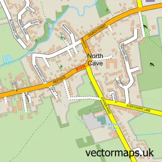
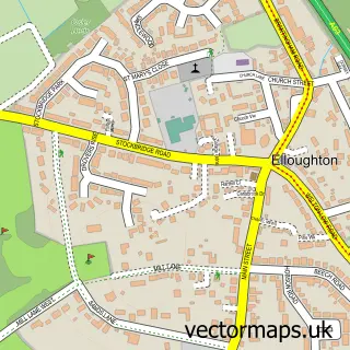
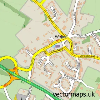
This South Cave street map is a detailed vector street map covering a 750m x 750m area. Select a larger area to create and download your own vector street map of South Cave.

South Cave is a town in East Riding Of Yorkshire, in the Yorkshire And The Humber of England. Historically, the area formed part of Yorkshire. The settlement falls within the Haltemprice And Howden parliamentary constituency. It is served by the HU15 post

The 750-metre map sample for South Cave covers 561 mapped buildings and approximately 10.2 km of road detail, of which 22 named roads are named. The immediate area includes 2 pubs and 2 MOT stations within 2 miles. The wider area around South Cave features 1 tourism point of interest and 2 food and drink venues. To create a larger or custom map of South Cave, the map builder lets you define your own coverage area and download editable SVG, PDF and PNG files.

561Buildings
10.2 kmRoads
22Named roads
2,277Residents within 2 miles
Create your own

Create a larger editable map of South Cave

Choose any area you need and generate a high-quality vector map instantly. Perfect for print, planning, design, business and personal use.

Choose any location
Editable SVG files
Any size up to A0
PDF, PNG & more
Instant download
High quality guaranteed
Create My Custom Map
Secure, private & no credit card required
South Cave Vector Street Map
750m Sample
South Cave vector street map sample showing roads, buildings and local features in a 750 metre preview area
Buy South Cave Map Print from £12.95 Buy South Cave Digital Map from £6

This South Cave street map in East Riding of Yorkshire is available as downloadable SVG, PDF and PNG map files, or as a printed map for planning, business, display, education, local information and design work. You can also create a larger custom map area using the map selector.

What this South Cave map sample shows

South Cave lies within South Cave Cp parish, part of Dale ward in the East Riding Of Yorkshire local authority area. The postcode geography for this area includes the HU postcode area, the HU15 postcode district and the HU15 2 postcode sector. Residents fall under the Nhs Humber And North Yorkshire Integrated Care Board for NHS services.

Local features near South Cave

Within 2 miles

Amenities and services in and around South Cave.

2 MOT stations within 2 miles
1 Tourism & leisure
2 Food & drink
2 Pubs
4 Healthcare POIs
1 Vehicle services

Counts are approximate and based on publicly available data.

Administrative and postcode information for South Cave

South Cave lies within South Cave Cp parish, part of Dale ward in the East Riding Of Yorkshire local authority area. The postcode geography for this area includes the HU postcode area, the HU15 postcode district and the HU15 2 postcode sector. Residents fall under the Nhs Humber And North Yorkshire Integrated Care Board for NHS services.

Parish South Cave CP
Ward Dale
District / local authority East Riding of Yorkshire
County East Riding of Yorkshire
Historic county Yorkshire
Postcode district HU15
Postcode sector HU15 2
Parliamentary constituency Haltemprice and Howden
Region Yorkshire and the Humber
Country England

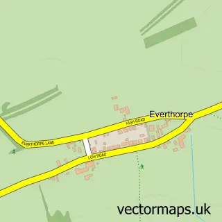
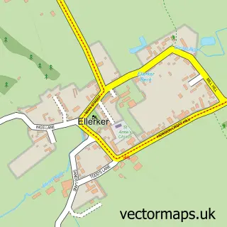
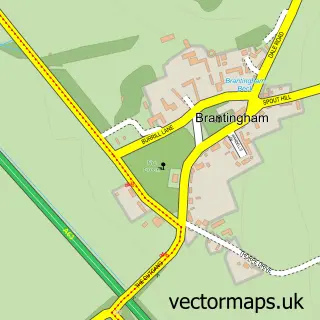
Nearby street map samples around South Cave

Street map sample of Hull, East Riding of Yorkshire Hull City - East Riding of Yorkshire - 10.9 miles Street map sample of Everthorpe, East Riding of Yorkshire Everthorpe Village - East Riding of Yorkshire - 1.1 miles Street map sample of Ellerker, East Riding of Yorkshire Ellerker Village - East Riding of Yorkshire - 1.1 miles Street map sample of Brantingham, East Riding of Yorkshire Brantingham Village - East Riding of Yorkshire - 1.5 miles Street map sample of North Cave, East Riding of Yorkshire North Cave Village - East Riding of Yorkshire - 1.9 miles Street map sample of Elloughton, East Riding of Yorkshire Elloughton Village - East Riding of Yorkshire - 2.4 miles Street map sample of Hotham, East Riding of Yorkshire Hotham Village - East Riding of Yorkshire - 2.5 miles Street map sample of South Newbald, East Riding of Yorkshire South Newbald Village - East Riding of Yorkshire - 2.9 miles Street map sample of Brough, East Riding of Yorkshire Brough Village - East Riding of Yorkshire - 3.1 miles Street map sample of Welton, East Riding of Yorkshire Welton Village - East Riding of Yorkshire - 3.3 miles

More street maps in East Riding of Yorkshire

Street map sample of Everthorpe, East Riding of Yorkshire Everthorpe Village - 1.1 miles Street map sample of Ellerker, East Riding of Yorkshire Ellerker Village - 1.1 miles Street map sample of Brantingham, East Riding of Yorkshire Brantingham Village - 1.5 miles Street map sample of North Cave, East Riding of Yorkshire North Cave Village - 1.9 miles Street map sample of Elloughton, East Riding of Yorkshire Elloughton Village - 2.4 miles

750 metre map area coverage

Boundary, postcode and point of interest information for the 750m x 750m rectangle centred on this sample map.

Boundaries containing map centre

Constituency: Goole and Pocklington Co Const

District: East Riding of Yorkshire

Icb: NHS Humber and North Yorkshire ICB

Parish: South Cave CP

Police Force: humberside

Postcode District: HU15

Postcode Sector: HU15 2

Ward: Dale Ward

Nearby boundaries intersecting sample

No additional intersecting boundaries found.

Postcode coverage

HU15 HU15 2

POI category counts

Party Supply: 3

Advertising Agency: 2

Barber: 2

Beauty And Spa: 2

Beauty Product Supplier: 2

Beauty Salon: 2

Convenience Store: 2

Dentist: 2

Funeral Services And Cemeteries: 2

Gym: 2

Sample points of interest

  • RED International Advertising Agency
  • Red International Communication Limited Advertising Agency
  • KR Hypnotherapy Alternative Medicine
  • Hills Car Care Limited Automotive Repair
  • Bodrum barber Barber
  • Morgans Barber Shoppe Barber
  • Alternative Beauty And Spa
  • Dash Beauty Beauty And Spa
  • Editions Hair & Beauty Beauty Product Supplier
  • The Sanctuary @ Editions, South Cave Beauty Product Supplier
  • Beauty by Kirsty Jade Beauty Salon
  • The Hideaway Nails & Beauty Beauty Salon

Create a larger editable map of South Cave

This sample shows only a 750 metre area. To create a larger map of South Cave, use our map builder to choose your own coverage area, add titles and download editable SVG, PDF and PNG files.

Create a custom map of South Cave

Phone 01751 473136 | Copyright Vectormaps.uk 2026

Samples Customizer Privacy Disclaimer
South Cave Vector Street Map
South Cave enlarged street map sample showing a 750 metre preview area