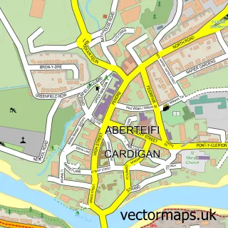
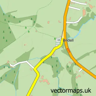
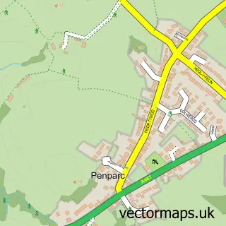
This St Dogmaels street map is a detailed vector street map covering a 750m x 750m area. Select a larger area to create and download your own vector street map of St Dogmaels.
The 750-metre map sample for St Dogmaels covers 255 mapped buildings and approximately 13.1 km of road detail, of which 22 named roads are named. The immediate area includes 1 school, 1 pub and 2 MOT stations, with 4 within 2 miles. The wider area around St Dogmaels features 5 tourism points of interest, 2 food and drink venues and 1 hotel. To create a larger or custom map of St Dogmaels, the map builder lets you define your own coverage area and download editable SVG, PDF and PNG files.
Create a larger editable map of St Dogmaels
Choose any area you need and generate a high-quality vector map instantly. Perfect for print, planning, design, business and personal use.

This St Dogmaels street map in Dyfed is available as downloadable SVG, PDF and PNG map files, or as a printed map for planning, business, display, education, local information and design work. You can also create a larger custom map area using the map selector.
What this St Dogmaels map sample shows
St Dogmaels lies within St. Dogmaels Community parish, part of St. Dogmaels ward in the Sir Benfro - Pembrokeshire local authority area. The postcode geography for this area includes the SA postcode area, the SA43 postcode district and the SA43 3 postcode sector. Residents fall under the Hywel Dda University Health Board for NHS services.
Local features near St Dogmaels
Within 2 milesAmenities and services in and around St Dogmaels.
Administrative and postcode information for St Dogmaels
St Dogmaels lies within St. Dogmaels Community parish, part of St. Dogmaels ward in the Sir Benfro - Pembrokeshire local authority area. The postcode geography for this area includes the SA postcode area, the SA43 postcode district and the SA43 3 postcode sector. Residents fall under the Hywel Dda University Health Board for NHS services.
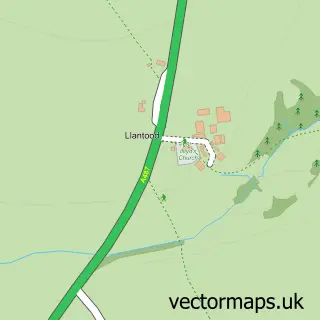
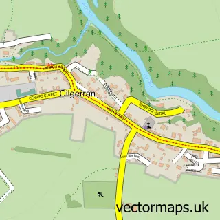
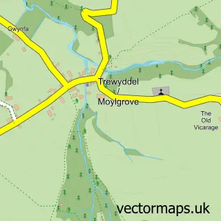
Nearby street map samples around St Dogmaels

More street maps in Dyfed
750 metre map area coverage
Boundary, postcode and point of interest information for the 750m x 750m rectangle centred on this sample map.
Boundaries containing map centre
Constituency: Ceredigion Preseli Co Const
District: Sir Benfro - Pembrokeshire
Icb: Hywel Dda
Parish: St. Dogmaels Community
Police Force: dyfed-powys
Postcode District: SA43
Postcode Sector: SA43 3
Nearby boundaries intersecting sample
District: Sir Ceredigion - Ceredigion
Parish: Cardigan Community
Postcode Sector: SA43 1
Postcode coverage
POI category counts
Landmark And Historical Building: 3
Convenience Store: 2
Fish And Chips Restaurant: 2
Active Life: 1
Arts And Crafts: 1
Bar: 1
Beauty And Spa: 1
Bed And Breakfast: 1
Boat Rental And Training: 1
Building Supply Store: 1
Sample points of interest
- Pembrokeshire Paragliding
- Oriel Ty Llwyd
- Teifi Netpool Inn
- Cariad Nails
- Bethsaida B&B
- A Bay to Remember
- Jewson
- St Dogmaels Coach House / Y Cartws Llandoch
- B V Rees Ltd
- St Dogmaels Memorial Hall
- Premier Siop Y Pentre
- Premier St. Dogmaels - Siop y Pentref Llandudoch
Create a larger editable map of St Dogmaels
This sample shows only a 750 metre area. To create a larger map of St Dogmaels, use our map builder to choose your own coverage area, add titles and download editable SVG, PDF and PNG files.
Create a custom map of St Dogmaels