This Stelling Minnis street map is a detailed vector street map covering a 750m x 750m area. Select a larger area to create and download your own vector street map of Stelling Minnis.
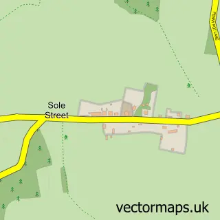
The 750-metre map sample for Stelling Minnis covers 146 mapped buildings and approximately 9.6 km of road detail, of which 6 named roads are named. The immediate area includes 1 pub. The wider area around Stelling Minnis features 3 tourism points of interest, 1 food and drink venue and 1 hotel. To create a larger or custom map of Stelling Minnis, the map builder lets you define your own coverage area and download editable SVG, PDF and PNG files.
Create a larger editable map of Stelling Minnis
Choose any area you need and generate a high-quality vector map instantly. Perfect for print, planning, design, business and personal use.

This Stelling Minnis street map in Kent is available as downloadable SVG, PDF and PNG map files, or as a printed map for planning, business, display, education, local information and design work. You can also create a larger custom map area using the map selector.
What this Stelling Minnis map sample shows
Stelling Minnis lies within Stelling Minnis Cp parish, part of North Downs West ward in the Folkestone And Hythe District local authority area. The postcode geography for this area includes the CT postcode area, the CT4 postcode district and the CT4 6 postcode sector. Residents fall under the Nhs Kent And Medway Integrated Care Board for NHS services.
Local features near Stelling Minnis
Within 2 milesAmenities and services in and around Stelling Minnis.
Administrative and postcode information for Stelling Minnis
The local authority covering Stelling Minnis is Folkestone And Hythe District, within the county of Kent. The settlement lies within North Downs West ward and Stelling Minnis Cp civil parish. The CT4 postcode district and CT4 6 postcode sector serve the immediate area. NHS provision in the area is delivered through East Kent Hospitals University Nhs Foundation Trust.
Nearby street map samples around Stelling Minnis

More street maps in Kent
750 metre map area coverage
Boundary, postcode and point of interest information for the 750m x 750m rectangle centred on this sample map.
Boundaries containing map centre
Constituency: Ashford Co Const
County: Kent County
District: Folkestone and Hythe District
Icb: NHS Kent and Medway ICB
Parish: Stelling Minnis CP
Police Force: kent
Postcode District: CT4
Postcode Sector: CT4 6
Ward: North Downs West Ward
Nearby boundaries intersecting sample
No additional intersecting boundaries found.
Postcode coverage
POI category counts
Landmark And Historical Building: 2
Advertising Agency: 1
Business Management Services: 1
Campground: 1
Convenience Store: 1
Farm: 1
Hotel: 1
Package Locker: 1
Pet Services: 1
Pub: 1
Sample points of interest
- Jagger Creative Communication
- Post Office-Stelling Minnis
- Knowler Farm
- Stelling Minnis Post Office and Stores
- Stelling Minnis - Knowler Farm
- Courthope Farm Holiday Cottages
- Bodsham
- Davison's Mill
- InPost
- The Lord Whisky Sanctuary
- Rose and Crown
- Sarradown House
Create a larger editable map of Stelling Minnis
This sample shows only a 750 metre area. To create a larger map of Stelling Minnis, use our map builder to choose your own coverage area, add titles and download editable SVG, PDF and PNG files.
Create a custom map of Stelling Minnis