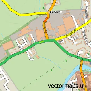
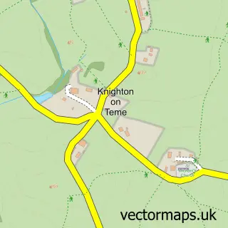
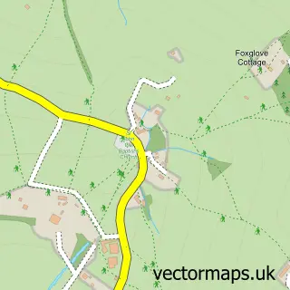
This Tenbury Wells street map is a detailed vector street map covering a 750m x 750m area. Select a larger area to create and download your own vector street map of Tenbury Wells.
The 750-metre map sample for Tenbury Wells covers 330 mapped buildings and approximately 34.5 km of road detail, of which 28 named roads are named. The immediate area includes 1 school, 1 GP surgery within 2 miles, 6 pubs and 3 MOT stations within 2 miles. The wider area around Tenbury Wells features 3 tourism points of interest and 7 food and drink venues. To create a larger or custom map of Tenbury Wells, the map builder lets you define your own coverage area and download editable SVG, PDF and PNG files.
Create a larger editable map of Tenbury Wells
Choose any area you need and generate a high-quality vector map instantly. Perfect for print, planning, design, business and personal use.

This Tenbury Wells street map in Worcestershire is available as downloadable SVG, PDF and PNG map files, or as a printed map for planning, business, display, education, local information and design work. You can also create a larger custom map area using the map selector.
What this Tenbury Wells map sample shows
Tenbury Wells lies within Tenbury Cp parish, part of Tenbury ward in the Malvern Hills District local authority area. The postcode geography for this area includes the WR postcode area, the WR15 postcode district and the WR15 8 postcode sector. Residents fall under the Nhs Herefordshire And Worcestershire Integrated Care Board for NHS services.
Local features near Tenbury Wells
Within 2 milesAmenities and services in and around Tenbury Wells.
Administrative and postcode information for Tenbury Wells
The local authority covering Tenbury Wells is Malvern Hills District, within the county of Worcestershire. The settlement lies within Tenbury ward and Tenbury Cp civil parish. The WR15 postcode district and WR15 8 postcode sector serve the immediate area. NHS provision in the area is delivered through Worcestershire Acute Hospitals Nhs Trust.
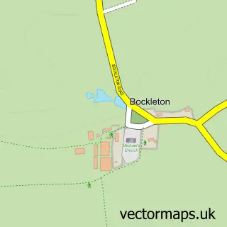
Nearby street map samples around Tenbury Wells

More street maps in Worcestershire
750 metre map area coverage
Boundary, postcode and point of interest information for the 750m x 750m rectangle centred on this sample map.
Boundaries containing map centre
Constituency: West Worcestershire Co Const
County: Worcestershire County
District: Malvern Hills District
Icb: NHS Herefordshire and Worcestershire ICB
Parish: Tenbury CP
Police Force: west mercia
Postcode District: WR15
Postcode Sector: WR15 8
Ward: Tenbury Ward
Nearby boundaries intersecting sample
Constituency: South Shropshire Co Const
District: Shropshire
Icb: NHS Shropshire Telford and Wrekin ICB
Parish: Burford CP
Postcode coverage
POI category counts
Pub: 6
Retail: 4
Beauty And Spa: 3
Beauty Salon: 3
Dentist: 3
Flowers And Gifts Shop: 3
Grocery Store: 3
Hair Salon: 3
Indian Restaurant: 3
Professional Services: 3
Sample points of interest
- Sue Ryder Tenbury Wells
- Pitter Potter
- Teme Valley Artisans
- Midcounties Co-Op Tenbury Wells (ERF)
- Will's Auto Repairs
- Vehicle Handling Solutions
- Richard C Swift
- Sues Bespoke Cakes
- Corporate Finance Associates
- Top kurdish barber-tenbury
- KB Beauty Boutique
- Lianne Lloyd Aesthetics, Beauty & Extensions
Create a larger editable map of Tenbury Wells
This sample shows only a 750 metre area. To create a larger map of Tenbury Wells, use our map builder to choose your own coverage area, add titles and download editable SVG, PDF and PNG files.
Create a custom map of Tenbury Wells