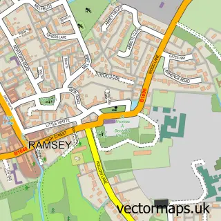
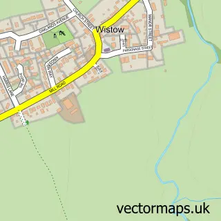
This Upwood street map is a detailed vector street map covering a 750m x 750m area. Select a larger area to create and download your own vector street map of Upwood.
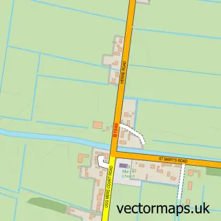
The 750-metre map sample for Upwood covers 222 mapped buildings and approximately 9.7 km of road detail, of which 13 named roads are named. The immediate area includes 1 pub. The wider area around Upwood features 1 food and drink venue. To create a larger or custom map of Upwood, the map builder lets you define your own coverage area and download editable SVG, PDF and PNG files.
Create a larger editable map of Upwood
Choose any area you need and generate a high-quality vector map instantly. Perfect for print, planning, design, business and personal use.

This Upwood street map in Cambridgeshire is available as downloadable SVG, PDF and PNG map files, or as a printed map for planning, business, display, education, local information and design work. You can also create a larger custom map area using the map selector.
What this Upwood map sample shows
Upwood lies within Upwood And The Raveleys Cp parish, part of Warboys ward in the Huntingdonshire District local authority area. The postcode geography for this area includes the PE postcode area, the PE26 postcode district and the PE26 2 postcode sector. Residents fall under the Nhs Cambridgeshire And Peterborough Integrated Care Board for NHS services.
Local features near Upwood
Within 2 milesAmenities and services in and around Upwood.
Administrative and postcode information for Upwood
Upwood lies within Upwood And The Raveleys Cp parish, part of Warboys ward in the Huntingdonshire District local authority area. The postcode geography for this area includes the PE postcode area, the PE26 postcode district and the PE26 2 postcode sector. Residents fall under the Nhs Cambridgeshire And Peterborough Integrated Care Board for NHS services.
Nearby street map samples around Upwood

More street maps in Cambridgeshire
750 metre map area coverage
Boundary, postcode and point of interest information for the 750m x 750m rectangle centred on this sample map.
Boundaries containing map centre
Constituency: Huntingdon Co Const
County: Cambridgeshire County
District: Huntingdonshire District
Icb: NHS Central East ICB
Parish: Upwood and the Raveleys CP
Police Force: cambridgeshire
Postcode District: PE26
Postcode Sector: PE26 2
Ward: Warboys Ward
Nearby boundaries intersecting sample
No additional intersecting boundaries found.
Postcode coverage
POI category counts
Automotive Repair: 2
Church Cathedral: 2
It Service And Computer Repair: 2
Accountant: 1
Assisted Living Facility: 1
Construction Services: 1
Hunting And Fishing Supplies: 1
Library: 1
Pizza Restaurant: 1
Plumbing: 1
Sample points of interest
- Whiting & Partners
- Manor House Residential & Nursing Home
- Upwood Auto Repair Centre
- Upwood Auto Repair Centre
- Saint Peter's Church Upwood
- St Peter's Church
- Fenland Hire
- Bruce and Walker
- Systemsoft
- Tesseration
- Upwood Village Book Exchange
- Mooi Pizza
Create a larger editable map of Upwood
This sample shows only a 750 metre area. To create a larger map of Upwood, use our map builder to choose your own coverage area, add titles and download editable SVG, PDF and PNG files.
Create a custom map of Upwood