Vector Maps logo
Home Why it works Popular maps Districts Samples Customizer Create Your Map
VectorMaps.uk
Home Popular maps Districts Samples Customizer Create Your Map Privacy Disclaimer
Home / UK Maps / Caithness / Wick Map

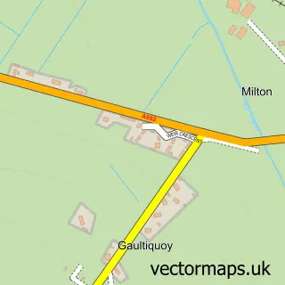
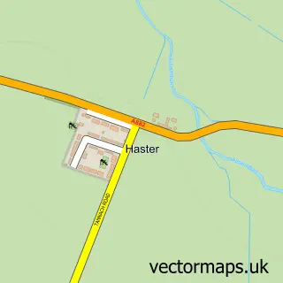
This Wick street map is a detailed vector street map covering a 750m x 750m area. Select a larger area to create and download your own vector street map of Wick.

Wick is a town in Caithness, in the Highlands And Islands of Scotland. The settlement falls within the Caithness, Sutherland And Easter Ross parliamentary constituency. It is served by the KW1 postcode district, with KW1 5 as the local postcode sector.

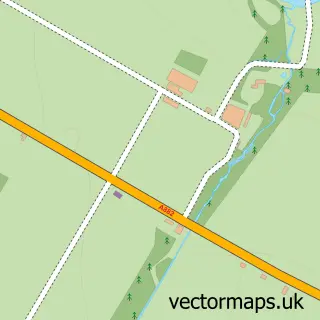
The 750-metre map sample for Wick covers 125 mapped buildings and approximately 21.8 km of road detail, of which 54 named roads are named. The immediate area includes 1 railway station, 1 GP surgery, 4 pubs and 1 MOT station, with 3 within 2 miles. The wider area around Wick features 6 tourism points of interest, 14 food and drink venues and 5 hotels. To create a larger or custom map of Wick, the map builder lets you define your own coverage area and download editable SVG, PDF and PNG files.

125Buildings
21.78 kmRoads
54Named roads
0Residents within 2 miles
Create your own

Create a larger editable map of Wick

Choose any area you need and generate a high-quality vector map instantly. Perfect for print, planning, design, business and personal use.

Choose any location
Editable SVG files
Any size up to A0
PDF, PNG & more
Instant download
High quality guaranteed
Create My Custom Map
Secure, private & no credit card required
Wick Vector Street Map
750m Sample
Wick vector street map sample showing roads, buildings and local features in a 750 metre preview area
Buy Wick Map Print from £12.95 Buy Wick Digital Map from £6

This Wick street map in Caithness is available as downloadable SVG, PDF and PNG map files, or as a printed map for planning, business, display, education, local information and design work. You can also create a larger custom map area using the map selector.

What this Wick map sample shows

Wick lies within Highland parish, part of Wick And East Caithness ward in the Highland local authority area. The postcode geography for this area includes the KW postcode area, the KW1 postcode district and the KW1 5 postcode sector. Residents fall under the Highland for NHS services.

Local features near Wick

Within 2 miles

Amenities and services in and around Wick.

1 Railway stations
1 Campsites within 2 miles
1 GP surgeries 1 within 2 miles
1 MOT stations 3 within 2 miles
6 Tourism & leisure
14 Food & drink
4 Pubs
5 Hotels
12 Healthcare POIs

Counts are approximate and based on publicly available data.

Administrative and postcode information for Wick

Wick lies within Highland parish, part of Wick And East Caithness ward in the Highland local authority area. The postcode geography for this area includes the KW postcode area, the KW1 postcode district and the KW1 5 postcode sector. Residents fall under the Highland for NHS services.

Parish HIGHLAND
Ward Wick and East Caithness
District / local authority Highland
County Caithness
Historic county Caithness
Postcode district KW1
Postcode sector KW1 5
Parliamentary constituency Caithness, Sutherland and Easter Ross
Region Highlands and Islands
Country Scotland

Nearby street map samples around Wick

Street map sample of Inverness, Inverness Inverness City - Inverness - 78.5 miles Street map sample of Milton, Caithness Milton Village - Caithness - 1.1 miles Street map sample of Newton, Caithness Newton Village - Caithness - 1.3 miles Street map sample of Papigoe, Caithness Papigoe Village - Caithness - 1.3 miles Street map sample of Staxigoe, Caithness Staxigoe Village - Caithness - 1.5 miles Street map sample of Haster, Caithness Haster Village - Caithness - 2.3 miles Street map sample of Reiss, Caithness Reiss Village - Caithness - 3.1 miles Street map sample of Thrumster, Caithness Thrumster Village - Caithness - 3.9 miles Street map sample of Sarclet, Caithness Sarclet Village - Caithness - 4.7 miles Street map sample of Bilbster, Caithness Bilbster Village - Caithness - 5.4 miles

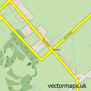
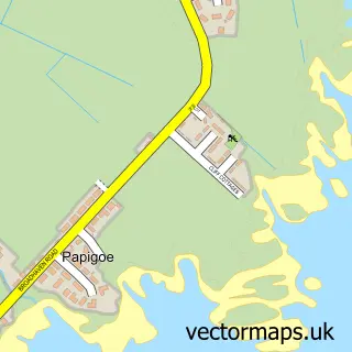
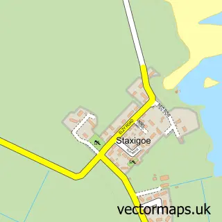
More street maps in Caithness

Street map sample of Milton, Caithness Milton Village - 1.1 miles Street map sample of Newton, Caithness Newton Village - 1.3 miles Street map sample of Papigoe, Caithness Papigoe Village - 1.3 miles Street map sample of Staxigoe, Caithness Staxigoe Village - 1.5 miles Street map sample of Haster, Caithness Haster Village - 2.3 miles

750 metre map area coverage

Boundary, postcode and point of interest information for the 750m x 750m rectangle centred on this sample map.

Boundaries containing map centre

Constituency: Caithness, Sutherland and Easter Ross Co Const

District: Highland

Icb: Highland

Postcode District: KW1

Postcode Sector: KW1 4

Ward: Wick and East Caithness Ward

Nearby boundaries intersecting sample

Postcode Sector: KW1 5

Postcode coverage

KW1 KW1 4 KW1 5

POI category counts

Flowers And Gifts Shop: 6

Banks: 5

Beauty Salon: 5

Charity Organization: 5

Hair Salon: 5

Hotel: 5

Bed And Breakfast: 4

Cafe: 4

Convenience Store: 4

Pub: 4

Sample points of interest

  • Harbour Bridge 128 Accommodation
  • Reid & Fraser Accountant
  • Robertsons Of Tain North Agricultural Service
  • W & A Geddes Agricultural Service
  • Riverside Car Park Amusement Park
  • The Cobblestones Gallery Art Gallery
  • Pipe Band Hall Arts And Entertainment
  • Wick Assembly Rooms Arts And Entertainment
  • The Great Wall Asian Restaurant
  • Gordon Motors Automotive Repair
  • Divas & Dudes Baby Gear And Furniture
  • The Cliff Bakery Bakery

Create a larger editable map of Wick

This sample shows only a 750 metre area. To create a larger map of Wick, use our map builder to choose your own coverage area, add titles and download editable SVG, PDF and PNG files.

Create a custom map of Wick

Phone 01751 473136 | Copyright Vectormaps.uk 2026

Samples Customizer Privacy Disclaimer
Wick Vector Street Map
Wick enlarged street map sample showing a 750 metre preview area